Geology Reference
In-Depth Information
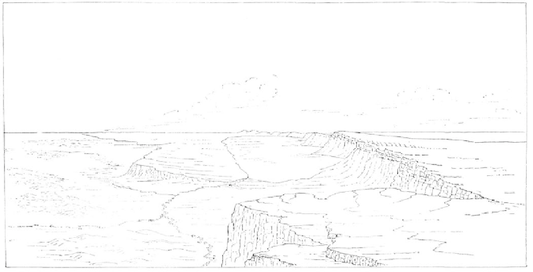
A sketch of Lake Abert, Lake County, by I.C. Rus-
sell, 1884.
libraries. In Oregon there is an "unofficial" copy at the notes of geologic interest, the main contributions from
University of Oregon Library in Eugene, although the his trip were some fossil plant specimens from the
accompanying atlas of illustrations is missing. Cascades sent to James Hall, New York State paleon-
tologist, along with a map of Oregon and California.
Western Journeys
In 1848 when Congress restricted Dana's
Charles Fremont, while not trained as a Volume X to 100 copies, it generously funded the
geologist, cannot be ignored in the early examination publication of 20,000 copies of Fremont's "Geographic-
of the West. Certainly a person of curious and quixotic al Memoir upon Upper California" and Preuss' "Map
nature, Fremont could be called a "scientific explorer." of Oregon and Upper California." In actuality, most of
Fremont had married Jessie Benton, daughter of the the map was a synthesis of data on Oregon and Cali-
influential Senator Thomas Hart Benton from Missou- fornia from previous trips and other sources. An earlier
ri. After that Fremont had no difficulty obtaining "Map of the Exploring Expedition to the Rocky
appointments and funding from Congress for his trips Mountains in the year 1842 and to Oregon and Califor-
across the continent including one in 1843 to survey nia in the years 1843-4" by Preuss in 1845 was well-
Oregon Territory. The purpose of this, his second of drawn and accurate, but the Willamette Valley and
three western journeys, was political as well as scientif- Coast Range were left blank. These maps, as well as
ic. The expedition was charged with reporting on the others of this period, were topographic only and lacked
topography and collecting geologic and botanical
geology,
specimens in order to gain any knowledge of the
interior which might prove useful in substantiating the
Pacific Railroad Surveys, 1853-1855
claim of the United States government to the
"valley of
In 1853 an act of Congress was once again
the Columbia".
instrumental in furthering geologic knowledge of the
Departing in the spring of 1843, the Fremont
Pacific Northwest. The act was designated to employ
party of 39 men included the German map maker,
"such portion of the Corps of Topographical Engineers...
Charles Preuss. Once the group had crossed the
to make such explorations and surveys ... to ascertain the
Rockies, it journeyed down the south bank of the
most practical and economical route for a railroad from
Columbia to The Dalles. After a brief side trip to Ft.
the Mississippi River to the Pacific Ocean".
Congress
Vancouver for supplies, the party explored the region
budgeted $150,000 for this project and sent out
"a
east of the Cascades to Klamath Lake and down into
mineralogist and geologist, physician, naturalist..."
under
California. While Fremont's journal contains some
the leadership of the Topographical Engineers. These