Geology Reference
In-Depth Information
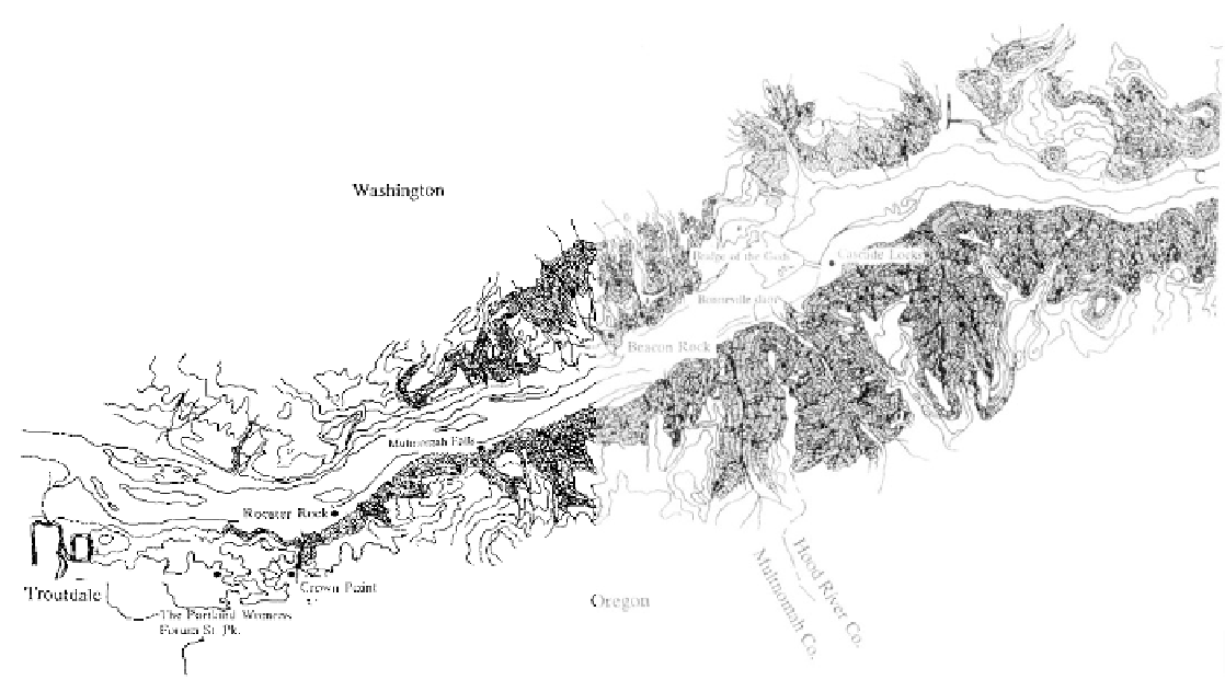
From The Dalles to Portland, the Columbia River is
entrenched in a gorge 72 miles long across the
Cascade Range.
pathways to continue the westward course. today. The tall columnar basalt pillar rises 200 hundred
In the middle Miocene, about 16 million years feet and is a favorite of rock climbers. The rock and
ago, this stretch of the river acted as a conduit for the surrounding acreage were purchased in 1938 for
massive Grande Ronde flows of the Columbia River $10,000 as a state park.
lavas. The ancient Columbia River canyon, with its In addition to lavas from the east, smaller
gentle slope toward the coast, offered a natural route flows from local volcanic vents in the Cascades periodi-
for lavas making their way to the Pacific Ocean. A cally disrupted the progress of the river through the
succession of flows poured into the gorge to harden gorge. Large lakes backed up behind these natural
and plug the flow of water. With each lava dam block- dams. Above Cascade Locks the remains of a delta are
ing its path, the Columbia cut a new channel in its visible where the ancestral Wind River lavas from the
northern bank, so it can be said that the Oregon Washington Cascades poured south to create a lake.
boundary gradually crept northward leaving a series of Before the waters eventually drained away, when the
lava filled channels to the south. Where they are river destroyed the dam, Wind River had constructed
exposed, the ancient channels have been mapped in the a delta 150 feet thick and one mile long in the ponded
gorge, but most of these have been completely covered waters.
over by later flows. Looking upriver at the Portland Landslides have had significant implications for
Women's Forum State Park near Corbett, two previous Oregon's past. It was along this section now covered by
channels can be seen where they are intersected by the the waters of Bonneville Dam that Indians and explor-
river today. One of these former channels is visible in ers found that the river dropped
"in continued rapids for
cross-section at nearby Crown Point. Exposed in the
three miles, not less than fifty feet,"
as Reverend Gusta-
sheer walls of the canyon below the point, a single flow vus Hines wrote in his diary in 1839. The river cascades
of Priest Rapids basalt, youngest member of the were created by a landslide of rocks, soil, and debris
Wanapum Formation, invaded the canyon of the into the riverbed less than a thousand years ago. This
Columbia River. The blocky jointed Priest Rapids slide which temporarily dammed the river, produced a
basalt is 500 feet thick covering more than 200 feet of land bridge from shore to shore and may be the origin
glassy, volcanic sediments which had choked the canyon of the Indian legend of the Bridge of the Gods report-
earlier.
ed at this point.
Nearby Rooster Rock is a mass of basalt,
similar to that at Crown Point, which slid from the
canyon wall into soft alluvium where it stands upright