Geology Reference
In-Depth Information
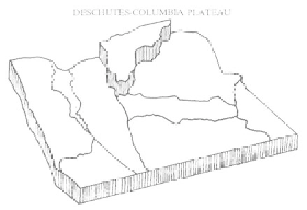
Deschutes-Columbia Plateau
Physiography
The Deschutes-Columbia River Plateau is pre-
dominantly a volcanic province covering approximately
63,000 square miles in Oregon, Washington, and Idaho.
The plateau is surrounded on all sides by mountains,
the Okanogan Highlands to the north in Washington,
the Cascade Range to the west and the Blue Mountains
to the south in Oregon, and the Clearwater Mountains
in Idaho to the east. Almost 200 miles long and 100
miles wide, the Columbia Plateau merges with the
Deschutes basin lying between the High Cascades and
Ochoco Mountains. The province slopes gently north-
ward toward the Columbia River with elevations up to
3,000 feet along the south and west margins down to a
few hundred feet along the river.
Primary rivers in the province are the west-flow-
ing Columbia River and its tributaries, the northward
flowing Deschutes, John Day, and Umatilla rivers,
along with Willow and Butter creeks, all of which enter
the Columbia between The Dalles and Wallula Gap.
The third largest river in North America, the Columbia
has the greatest impact on the plateau. Beginning in
British Columbia on the slopes of the Canadian
Rockies, the Columbia runs from the north to Wallula
Gateway where it makes a sharp bend toward the west.
Its watershed covers 259,000 square miles primarily in
southwest Canada, southern Washington, and northern
Oregon. Although smaller than the the Columbia, the
Deschutes River crosses the province in a northerly
direction to be joined by the Crooked and Metolius
rivers south of Lake Simtustus. From its beginning as
small streams near Mt. Bachelor, the Deschutes extends
250 miles before entering the Columbia just west of
Biggs. These streams have cut intricate, deep canyons
into the virtually horizontal lavas of the plateau.
Divides between the canyons are dissected, but broad,
flat uplands remain.
flow of basalts filled a subsiding basin to create a
featureless plateau. This volcanic activity was followed
by falling ash and lavas expelled from ancestral Cascade
volcanoes aligned on the western border of the Deschu-
tes Basin. Disrupted and blocked by the lavas, sedi-
ment-laden streams and the Deschutes River carried
the material northward, depositing much of it along the
channel filling the broad alluvial plain of the basin.
With the gradual subsidence of the Cascade vents into
a deep graben or depression and the resulting high
Green Ridge escarpment, the accumulation of volcanic
debris in the Deschutes basin shifted to lavas from
small local cones during the Pliocene. In the Pliocene
waters trapped behind structural ridges formed tempo-
rary lakes and ponds that filled with sediment. A broad
uplift of the plateau triggered an aggressive new
erosional phase where rivers carried away much of the
unconsolidated clay, silt, and sand and cut deep chan-
nels. Volcanism here ceased after massive lavas from
near Newberry Volcano entered the deep canyons, once
again disrupting the flow of the rivers.
Vast lake waters, impounded by glacial ice,
impacted the Columbia Plateau during the Pleistocene
when they were released from Montana sending cata-
strophic floods across the landscape to scour southeast-
ern Washington and the Columbia gorge.
Geologic Overview
Geologic events in the Columbia-Deschutes
province took place on a grand scale. Immense out-
pourings of lavas during the Miocene created one of
the largest flood basalt provinces in the world, second
only to the Deccan Plateau in India. Erupting from
source vents in central and northeast Oregon as well as
in southeast Washington and adjacent Idaho, flow after
121