Geology Reference
In-Depth Information
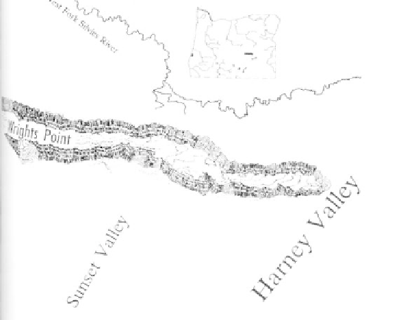
Wright's Point, a sinuous 250-foot high ridge in
Harney County, traces the channel of a meandering
stream that was permanently cast in basalt.
was repeatedly layered by this material. Once the
volcanism subsided, the river slowly began to erode its
way through the deposits to cut out the Crooked River
canyon seen today. Fluvial erosion by the river over
millions of years along with weathering of the rock
have combined to carve the sheer walls of Smith Rock,
which is formed of tan, red, and green tuffs of volcanic
ash and mud flows.
The exact source of the volcanic material
making up Smith Rock is uncertain. The eruptive
center may have been a vent a short distance from the
park, or Smith Rock itself may be the remnant of a low
angle tuff cone. Lava from the cone exploded when it
came into contact with groundwater and was expelled
as ash that was later consolidated into tuffs.
Carved by the Crooked River into vertical pillars and sheer cliffs, the Miocene volcanic ash of Smith
Rock is a favorite of rock climbers (photo courtesy of Oregon State Highway Department).