Geology Reference
In-Depth Information
Geology
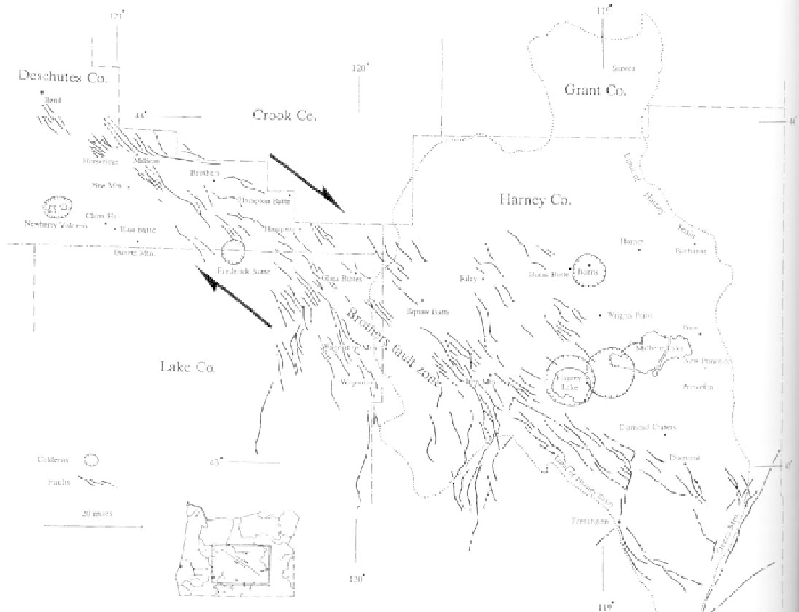
spaced a quarter to 2 miles apart with modest displace-
ments of less than 50 feet. Over 100 separate rhyolite
volcanic centers are located along the belt of faults
where the silica-rich lavas have exploited the fractures
and fissures as avenues to reach the surface.
The Brothers fault zone was generated by the
same forces that twisted Oregon in a clockwise motion
throughout the Cenozoic era. Large tectonic blocks
share a zone of weakness running north-south through
central Oregon. As the blocks move relative to each
other, the eastern block moved south and the western
block moved north. Caught in the middle, central
Oregon was distorted by wrench faulting expressed on
the surface as the wide zone of faults. Most of the
faults along the zone are so recent that they are easily
seen in aerial photographs. Similar large-scale wrench
faults in Oregon following the same northwest-south-
east trend are the Eugene-Denio and Mt. McLoughlin
faults to the south in the Basin and Range province.
Structurally the High Lava Plains blends with
the Blue Mountains to the north and the Basin and
Range to the south, but its volcanic characteristics set
it apart. The oldest rocks exposed in the High Lava
Plains province are Miocene lavas. Five to 10 million
years ago the landscape here was dotted with erupting
volcanoes and slow moving thick lavas spreading over
the flat surface. One eruption followed the other
almost continuously for millions of years. Eruptions
aligned themselves in a broad belt of overlapping
faults, known as the Brothers fault zone, the dominant
structural feature of the High Lava Plains and central
Oregon. The zone runs for 130 miles from Steens
Mountain in southeastern Oregon to Bend. Within the
Brothers fault zone, individual faults are irregularly
Cutting diagonally across the state, the Brothers fault zone consists of hundreds
of smaller faults above a major northwest by southeast shear. (after Walker and
Nolf, 1981)