Geology Reference
In-Depth Information
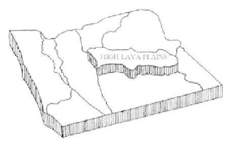
High Lava Plains
Physiography
The High Lava Plains physiographic province,
shaped roughly like a rectangle 50 miles wide and 150
miles long, is situated near the geographic center of
Oregon. A high plateau averaging just over one mile
above sea level, it is bordered by three other provinces,
the Blue Mountains to the north, the Basin and Range
and Owyhee Uplands to the south and east, and the
Cascade Range on the west. Within the narrow rectan-
gle, Newberry Crater and Harney Basin form the west
and east boundaries respectively.
The overall topography, as the name implies, is
smooth, with moderate relief. Elevation ranges from a
high of 7,984 feet at Paulina Peak to 4,080 feet above
sea level in Harney Basin. The lack of deep canyons
and gullies as well as a poorly developed network of
streams are due to the low rainfall. Precipitation of
only 10 to 20 inches a year in the plains regions is the
result of the Western Cascade rainshadow. This mini-
mal moisture has created an area of little vegetation
which makes the High Lava Plains an outstanding
region to see evidence of recent volcanic and tectonic
activity producing features that are still "fresh."
The headwaters of the Deschutes River are along
the western edge of the province, and most tributary
streams are seasonal with poorly defined channels.
Malheur and Harney lakes, the largest in the plains,
collect the drainage of the Silvies River and Silver
Creek from the north and the Donner and Blitzen
River from the Steens Mountain to the south. These
undrained basins contain playa lakes at certain times of
the year. At the center of the broad Harney Basin,
Malheur and Harney lakes are now nearly dry.
vents along a zone of faults erupted with pumice, ash,
and cinders along with thick viscous lava. The volcanic
activity here relates to a broad zone of faults and
fractures running across the province that resulted
from two enormous, underlying crustal blocks wrench-
ing past each other. Molten lava reached the surface by
way of the cracks to ooze onto the surface as large and
small volcanoes which are the hallmark of the province.
These volcanic events produced some of the most
interesting features of the High Lava Plains, where the
immense shield cone containing Newberry Crater, small
cinder cones, tuff rings, and explosion craters stand out
on the flat plateau. Many recent lava flows enclosing
trees created the unique Lava Cast Forest, while lava
caves formed in hollow tubes within the cooling lavas.
Lakes that characterized the Great Basin
during the Pleistocene filled many of the large depres-
sions of the Lava Plains. With the Ice Ages broad
expanses of the flat plains were covered with continu-
ous shallow-water lakes that served as a habitat for
mammals and birds. Throughout the province, these
basins received both fluvial sediments and ash from
contemporaneous volcanism until drying conditions
reduced them to the playas found today.
Geologic Overview
The High Lava Plains is a province of remark-
able volcanic features, most of which are the result of
relatively young eruptions. A multitude of volcanic
cones and buttes, lava flows, and lava tube caves are
scattered throughout the province. Except for deposits
of talus, lake sediments, and fluvial debris, most of the
rocks in the province are volcanic, and thick flows are
not unusual.
Volcanic eruptions of lava and ash beginning
10 million years ago continued into the Recent when
103