Travel Reference
In-Depth Information
usable by 1896 and the tunnel suffered a collapse in 1908 as a result of mining subsidence.
All commercial traffic ceased in 1962 although the earlier closure of Walkeringham brick-
works had been a major blow to commercial use.
The isolated canal runs eastwards from Chesterfield to the River Trent. It is a narrow wind-
ing canal, mostly quiet and rural and often passing through attractive wooded scenery. Much
has been restored.
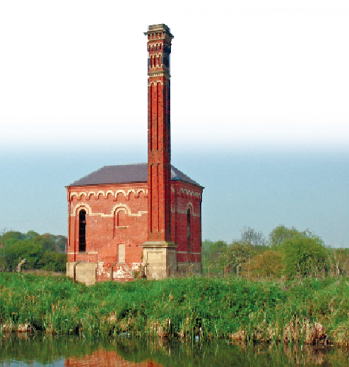
The pumping station by the Ryton aqueduct
.
The canal leaves the River Rother but follows its right bank for several kilometres. Tapton
Mill Floodgate is at a small brick bridge. The view back to Chesterfield (named from the Old
English for a Roman fort in open country) is crowned by the twisted and bent spire of St
Mary's church, which was hidden at the start.
A recent tunnel carries the A619 across just before Ford Lane Lock. The lock itself, to-
gether with its lock cottage, now a canal visitor centre, has the feeling of being in the middle
of a busy roundabout although traffic does not go all the way round. Artwork is displayed un-
der the first bridge. The Cuckoo Way long-distance footpath follows the canal and the Trans
Pennine Trail also uses the towpath to Staveley.