Geoscience Reference
In-Depth Information
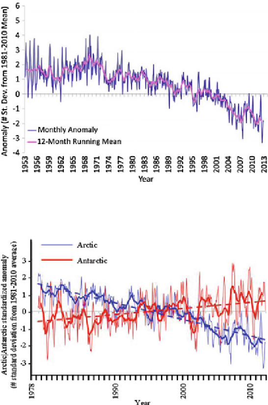
Fig. 5.6 Arctic sea ice extent
standardized anomalies,
January 1953
December 2012.
-
Fig. 5.7 Arctic and Antarctic standardized anomaly and trend, November 1978
December 2012.
-
The CSL is the point above which snow and ice cover the ground throughout the
year. The actual snow line may seasonally be signi
cantly lower. Typical CSLs are
given in Table
5.5
. The ELA marks the area or zone on a glacier where annual
accumulation and ablation are equal.
Numerical modeling using global climate models has shown (from considering
the growing concentration of GHGs and aerosols) that climate warming should
increase in the Arctic because of a feedback determined by the melting of the sea
ice and snow cover, causing a decrease in surface albedo. On the other hand, from
Search WWH ::

Custom Search