Geoscience Reference
In-Depth Information
isothermal layer varies, on the average, within a wide range from 10 m at the South
America
s coast to 130 m in the west part of the region. The position of thermocline
is determined by the separation boundary between surface and sub-surface waters.
An analysis of measured data obtained in this region permits one to select the
following model for the position of thermocline:
'
1
H
ð
u; k;
t
Þ
¼H
0
ð
t
Þþ
H
1
ð
t
Þ
H
0
ð
t
Þ
½
d
ð
t
Þ u
G
ðkÞ
½
ð
4
:
49
Þ
where H
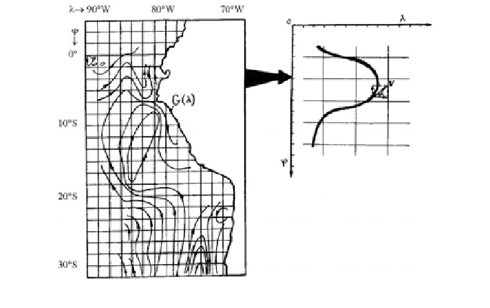
0
and H
1
are the occurrence depths of thermocline near the shore and in the
open ocean, respectively;
is the distance of the strip of maximum thermocline
depth from the shore that is described by function G(
ʴ
) (Fig.
4.6
).
The dynamics of biogeocenotic processes in the PCE is largely dependent on the
variable structure of currents. It is assumed that V
φ
=|V|cos
ʻ
ʱ
, V
ʻ
=|V|sin
ʱ
with angle
ʱ
showing the direction of the current at each point of the plane (
φ
,
ʻ
) at depth z.
fish migrations is proved to be the most com-
plex element in the construction of the PCEM. Lyapunov (1971) proposed that
the migration process should be identi
The mathematical description of
ed with the intense turbulent diffusion with
*
|>>|
ʽ
|. Krapivin (1978) realized this algorithm and has shown that
the estimation of
the coefficient |
ʽ
*
to be a very incorrect task. The investigations by Radakov
(1972) revealed that the process of
ʽ
fish migration is accompanied by an external
appearance of purposeful behavior. Therefore, the law of migration which follows
from the general biological principle of adaptation and long-term adaptability is
formulated: migrations of anchovy, predatory
fishes and birds are subordinated to
the principle of complex maximization of effective nutritive ration Pi
i
(i =5,7,8,9),
Fig. 4.6 A scheme for the superposition of spatial model structure with the current map
Search WWH ::

Custom Search