Geoscience Reference
In-Depth Information
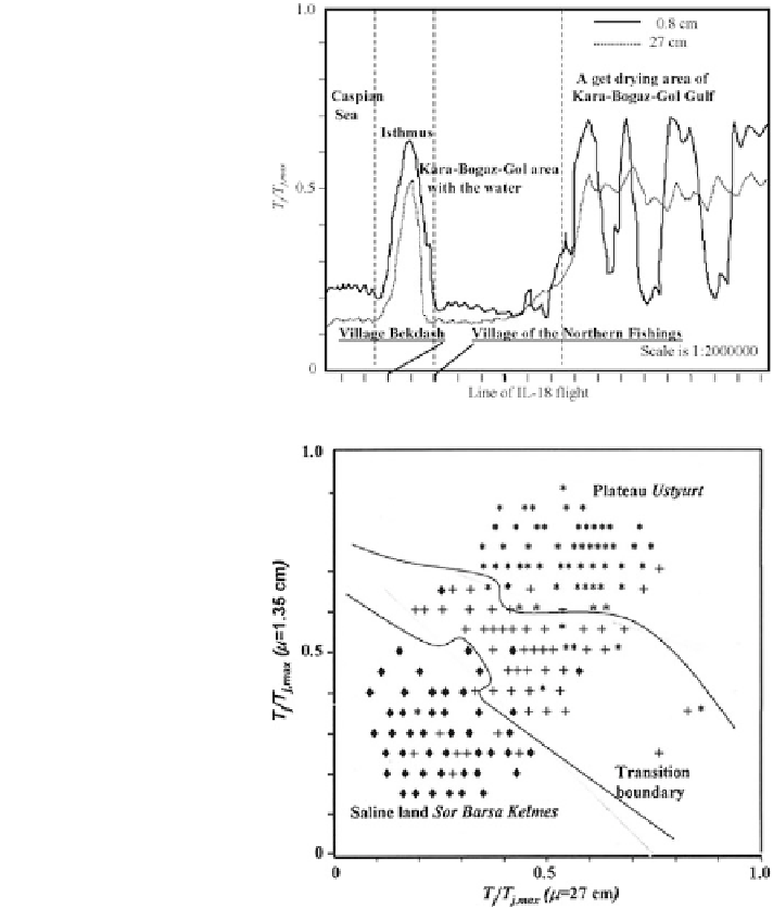
Fig. 3.11 Radiobrightness
contrasts in the area of the
Kara-Bogaz-Gol Gulf on the
eastern shore of the Caspian
Sea as registered on board the
flying laboratory IL-18
Fig. 3.12 Pro
le of the state
system image for the
'
Sor
Barsa Kelmes
'
saline land
—
'
Ustyurt
'
formed on
the basis of the IL-18 in-
plateau
—
fl
ight
laboratory measurements.
Symbols designate
saline
♦—
land, *
the
boundary between them
plateau, +
—
—
temperatures of this example are given in Fig.
3.13
and the statistical parameters of
the distributions are given in Table
3.2
. The use of brightness temperatures of multi-
channel measurements allows reliable recognition of land surfaces regardless of the
climatic zone (Fig.
3.14
). It is easy to see that the varied distributions do not
correspond to the land surface structure. However, the parametric space expansion
increases the ef
ciency of the decision system by including the distribution
characteristics.
The optimal procedure of the functioning of the decision system consists in the
joint use of the classical and sequential algorithms for data processing (see Fig.
3.5
).
This procedure saves time and gives the operative parameters of the distributions
Search WWH ::

Custom Search