Geoscience Reference
In-Depth Information
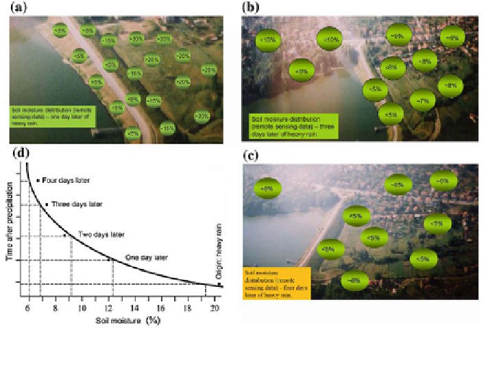
Fig. 2.15 Results of soil moisture retrieval in its dynamics in the Rusenski Lom region (Bulgaria)
as results of combined use of remote sensing measurements and the RIMS-B application
2
:
9134
ð
NDVI
Þ
0
:
3215
ð
NDVI
Þ
when NDVI
0
:
;
1
5
VWC ¼
2
4
:
2857
ð
NDVI
Þ
1
:
5429 when NDVI
0
:
5
;
[
where VWC is measured in kg m
2
.
Figure
2.15
demonstrates some results received by means of the GIMS using for
remote sensing data processing. Detailed and geo-referenced maps identifying the
locations of saturated and dry levees can be produced using microwave radiometric
measurements from a light aircraft or helicopter, and integrated with GPS for posi-
tioning and orientation. The development of synergetic remote sensing technology
for raised groundwater and seepage detection by the joint use of microwave and
optical data along with GIS databases is an effective and most contemporary way of
supporting risk assessment and facilitating disaster prevention and management.
2.5.3 Geoinformation System to Monitor Agriculture
The GIMS technology was set up to solve the wide range of problems arising in
agriculture (Reutov and Shutko 1986; Shutko 1986; Chukhlantsev 1986; Chukhlantsev
and Shutko 1988; Shutko et al. 2006a, b, 2010; Krapivin and Shutko 2012). The
properties of the interaction of electromagnetic energy with the soil-plant formations
Search WWH ::

Custom Search