Geology Reference
In-Depth Information
(a)
(b)
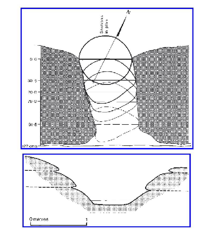
Figure 9.9.
(a) Section through rock basin on Kestor, Dartmoor, southwestern England. (b) Section through
cylindrical hollow, Kwaterski Rocks, northwestern Eyre Peninsula, South Australia.
intact. The site is near the sea, so that salt weathering may be involved, but the protective role of
lichen is clearly demonstrated.
The topographic distribution of various types of basin is consistent with the suggested expla-
nations of the major morphological types (
Fig. 9.2b).
Pans are most numerous on broadly rolling
upper surfaces or platforms, though armchair-shaped hollows are prominent on the steeper mar-
ginal zones. Pits occur in topographic lows, below the level of flaggy or laminated rock on which
pans are so profusely represented, and in homogeneous bedrock.
This explanation may be of general application, for only pans are developed in southwestern
England where the superficial zone of the granite outcrops, on which the rock basins were
developed, is flaggy. The basin on Kestor for example, has penetrated through two thick laminae
so that its cross section profile is irregular (Fig. 9.9a). The general point was appreciated more than
a century ago by Jones (1859), who wrote that the tabular (or flaggy) structure of the Dartmoor
granite was “
probably the cause of frequent occurrence of basins with flat bottoms
”.