Environmental Engineering Reference
In-Depth Information
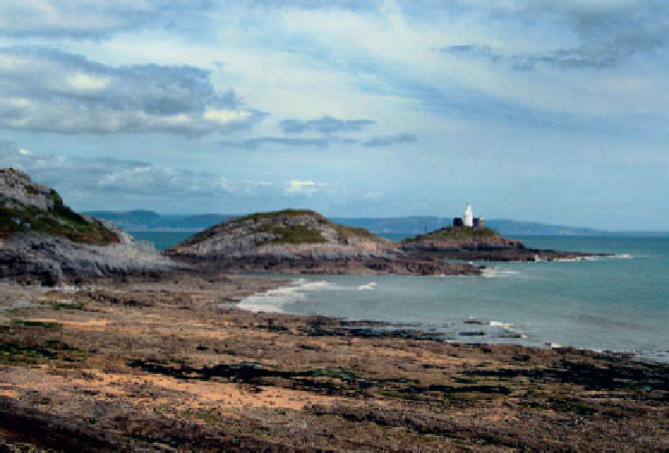
THE MUMBLES
Isaac Hamon noted that:
In this parish (Oystermouth) is a safe harbour as well on the sands or flats, as alsoe in ye roade,
commonly called Mumbles roade, here is two banks or Islands near the roade, commonly called
ye outer mumble & the middle mumble there is another bank or small cliffe almost an island wch
they call the inner mumble, in Welsh the 3 mumbles are called ye tair twarchen.
Aswiththeotherislands,thenameoftheMumblesisthoughttobederivedfromanotherlanguage,inthis
case from the French
mamelles
, meaning breasts, but there may be a Welsh derivation from
mammoel
,
which means a bare place or spot. The prominent twin limestone islands mark the western boundary of
Swansea Bay (Fig. 99). Middle Head is accessible at mid-tide and Mumbles Head on most low tides, but
as with the other islands the rising tide quickly isolates both of the Mumbles and great care is needed to
avoid becoming stranded. During spring tides people have been stranded for many hours.
On Mumbles Head itself is the lighthouse, built in 1793, which is now Gower's only working light,
and a coastal defence fort of 1861. Underneath the Head the huge cavern of Bob's Cave penetrates deep
intothesouthsideoftheisland.In1844theislandwasthesceneofsomeveryearlyexperimentsin'over-
water telegraphy' conducted by John Dillwyn-Llewelyn and Sir Charles Wheatstone, which anticipated
by many years Marconi's experiments with radio further up the Bristol Channel.
FIG
99.
The Mumbles, viewed from Bracelet Bay. (Jonathan Mullard)
As on the Worm, red fescue forms a deep sward on Mumbles Head itself, while other plants present
include sea stock, rock samphire and thrift. Hoary stock
Matthiola incana
grows on the cliffs below the
old lighthouse site and as it is a garden escape the plant may have been introduced by past lighthouse-
keepers (it also grows on the cliffs below the lighthouse at Nash Point on the Glamorgan Heritage Coast).