Geoscience Reference
In-Depth Information
the present Mt Princeton in the Collegiate
Range (
220
).
Some two million years after the Wall
Mountain Tuff, a new eruption affected
Florissant from an area known as the
Guffey volcanic center, about 25-30 km
(15-20 miles) south-west of Florissant.
This volcanic complex (also known as the
Thirtynine-mile Volcanic Field,
220
)
produced a variety of rock types, resulting
from lava flows, pyroclastic flows, ash
falls, debris avalanches, and lahars
(debris flows containing much water and
mud). The eruptions and the resulting
landscape would have been very similar to
Mt St. Helens in its 1980 eruption (
221
),
during which a debris avalanche swept at
27 m.s
-1
(60 mph) through the nearby
Spirit Lake (
222
) and overtopped
Johnston Ridge; a pyroclastic flow spread
at more than 300 m.s
-1
(650 mph),
destroying 600 square km (230 square
miles) of forest; and lahars, fuelled
by melted glacier ice, flowing at up to
12 m.s
-1
(27 mph) swept down the Toutle
River and into the Columbia River which,
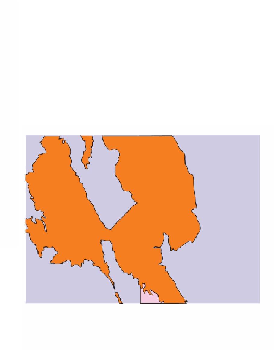
220
106°W
105°W
Florissant
Fossil Beds
National
Monument
SOUTH
PARK
Grizzly Peak
caldera
39°N
Buena
Vista
Thirty-nine
Mile volcanic
field
Colorado
Springs
Pikes
Peak
Mt Aetna
caldera
N
10 km
Bonanza
caldera
SAN
LUIS
VALLEY
10 miles
Miocene sediments
Mt Princeton batholith
caldera
Eocene-Oligocene volcanics
Paleozoic-middle Eocene sediments
limit of Wall
Mountain tuff
late Eocene sediments
Precambrian
220 Geological map of the Colorado Rockies in the vicinity of Florissant Fossil Beds National
Monument, showing relationship of Tertiary volcanic centers, Thirty-Nine Mile Volcanic Field,
and limit of Wall Mountain Tuff to the Florissant area after Evanoff et al., 2001.


Search WWH ::

Custom Search