Geology Reference
In-Depth Information
Svalbard
North Pole
Ward Hunt Ice Shelf
Drift track of
Canada's Ice Island
1983-1988
Alert
1983
1984
1985
1986
1987
Sept. 1988
Mar 1990
Ellesmere
Greenland
Island
CANADA
Mould Bay
Thule
Axel
Heiberg
Island
Ellef
Ringnes
Island
Beaufort Sea
Baffin
Bay
Resolute
CANADA
Eclipse Sound
Figure 5.35
Drift of the tabular iceberg (ice island), named Hobson's Choice during 1983-1988 after calving
from the Ward Hunt Ice Shelf in Ellesmere Island and final fragmentation during the summer of 1990 between
Ellef Ringness Island and Axel Heiberg Island (with changes from L. Jackson, Canadian Geographic, Dec'88/
Jan'89; courtesy of Polar Continental Shelf Project).
moved inside the Sverdrup basin. Massive rescue opera-
tions were then performed to recover all the facilities and
heavy test equipment used for medium‐scale indentation
tests, to be described briefly in the section 5.2.3.
During the 1980s, the largest natural ice island in the
Arctic Ocean remained to be the Hobson's Choice ice
island. Since a wide sea ice rubble field developed at the
floating edge of the East Ward Hunt Ice Shelf before the
calving events occurred in 1982, the ice island had a wall
of old ice, called “shelf‐fast rubble field” attached to it.
During its floating life as an ice island, it developed a new
wall of sea ice rubble field around the fractured surface
created in 1982-1983 when this massive ice section broke
off the ice shelf. Eventually, therefore, the island had
developed two sea ice components. Like a sandwich, it
consisted of a 40-45 m thick strip of shelf ice with 5-10
m thick MY ridged sea ice on either side, as illustrated in
Figure 5.38. Its total area was almost 34 km
2
and the
2
4
1
3
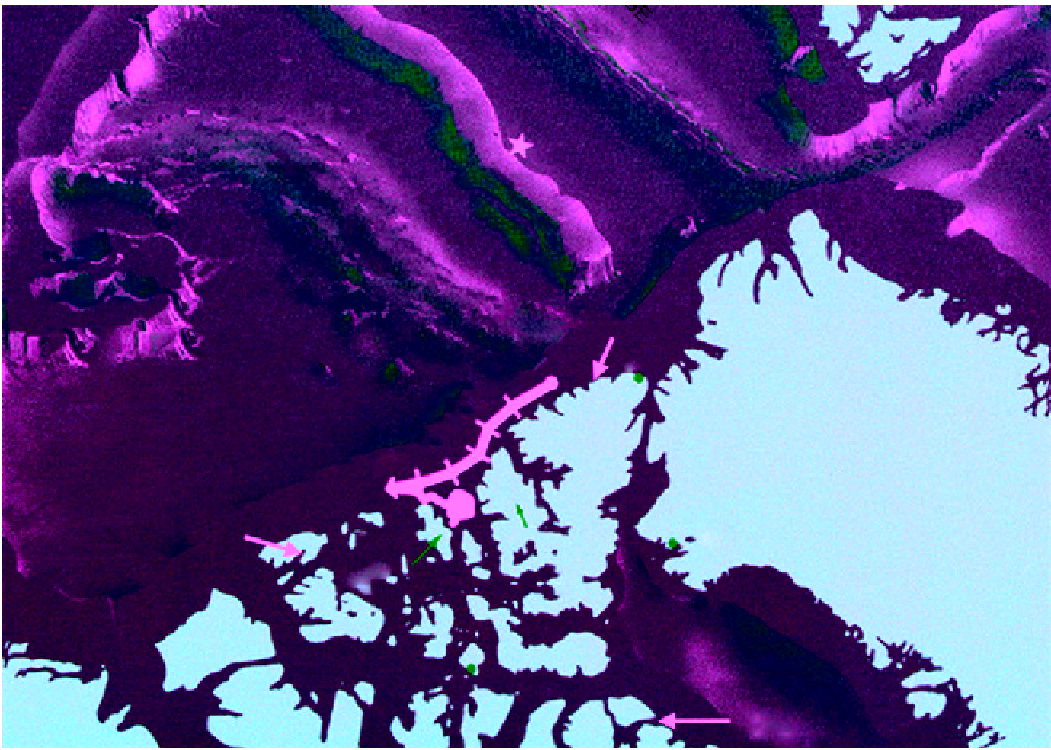
Figure 5.36
SAR image of the 8 km × 5 km ice island (1) and
two smaller ice islands (2, 3) calved from East Ward Hunt Ice
Shelf, and a large free‐floating MY sea ice floe (4) (with
changes, Courtesy, Polar Continental Shelf Project, Canada).