Global Positioning System Reference
In-Depth Information
1
2
3
4
5
6
7
8
9
10
11
12
13
14
15
16
17
18
19
20
21
22
23
24
25
26
27
28
29
30
31
32
33
34
35
36
37
38
39
40
41
42
43
44
45
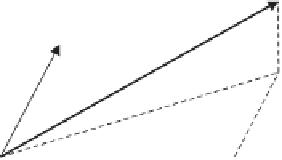
Figure 2.17
3D model observations.
Figure 2.17 shows the geodetic azimuth and vertical angle (or zenith angle) be-
tw
een points
P
1
and
P
2
in relation to the local geodetic coordinate system. One should
ke
ep in mind that the symbol
h
still denotes the geodetic height of a point above the
ell
ipsoid, whereas the
u
coordinate refers to the height of the second station
P
2
above
th
e local geodetic horizon of
P
1
. It follows that
[45
Lin
—
0.0
——
No
PgE
n
=
s
cos
β
cos
α
(2.89)
e
=
s
cos
β
sin
α
(2.90)
u
=
s
sin
β
(2.91)
The inverses of (2.89) to (2.91) are
tan
−
1
e
n
[45
α =
(2.92)
sin
−
1
u
s
β =
90°
−
ϑ
=
(2.93)
n
2
s
=
+
e
2
+
u
2
(2.94)
Th
e relationship between the local geodetic coordinate system and the geocentric
Ca
rtesian system (x) is illustrated in Figure 2.16:
n
−
∆
x
=
e
u
R
2
(ϕ
−
90°
)
R
3
(
λ −
180°
)
∆
y
∆
(2.95)
z
where
R
2
and
R
3
denote the rotation matrices given in Appendix A, and
∆
x
2
−
x
x
1
=
∆
X
≡
∆
y
2
−
(2.96)
y
∆
y
1
z
z
2
−
z
1