Travel Reference
In-Depth Information
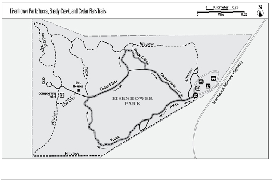
Miles and Directions
0.0
Start at the Yucca Trailhead heading west.
0.3
Reach a Y and take the right branch, heading southwest. The left branch is also the
Yucca Trail and part of a small loop that leads back to the main trail.
0.5
Pass a dry creek bed on the right, approximately 40 feet away. Low limestone outcrops
are on the right and left. Follow the trail as it takes a hard right, heading north.
1.0
Reach a junction where Cedar Flats Trail (an asphalt trail) crosses Yucca. Turn right, go-
ing east on Cedar Flats.
1.2
Reach a Y and take the left branch onto Shady Creek Trail, heading north. Note: The
0.3-mile Shady Creek Trail is rugged. This section may be eliminated by continuing south-
west on Cedar Flats toward the trailhead.
1.3
Reach a Y and take the right branch east, staying on Shady Creek.
1.4
Continue a short distance and reach a junction. Cross the bridge and follow Shady Creek
to the right (south). Follow the trail along a creek bed.
1.6
Reach a T where Shady Creek ends at Cedar Flats Trail (asphalt). Take the left branch,
heading southeast back toward Yucca.
1.7
Reach the T with Yucca, and take the left branch, heading east, and backtrack to the trail-
head.