Agriculture Reference
In-Depth Information
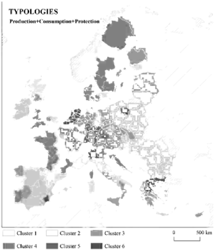
Fig. 3.2. Map of the distribution of types of regions in Europe according to their main modes
of rural occupancy. For Cluster names, see Fig. 3.1 (Source: authors).
The aim of this classification exercise was to explore a combined typology of rural
areas in Europe, where the balance between the role of production, consumption and
protection as drivers of the use of rural space, is effectively assessed. Classification is not
absolute but relative and is a tentative approach to how new modes of rural occupancy may
be distributed in Europe. To obtain a reasonable level of detail, the NUTS 2 level has been
selected as the scale of analysis. In order to identify each of the dimensions proposed by
Holmes (2006, 2012), a few variables were selected. The selection of variables has been
conditioned by the availability of data for the whole of Europe at the required scale. The
intention was to identify variables which could express production intensity (share of total
NUTS 2 area occupied by Utilized Agricultural Area; grazing livestock intensity; short

Search WWH ::

Custom Search