Geography Reference
In-Depth Information
According to the National Institute of Justice (NIJ), “mapping crime can help
law enforcement protect citizens more effectively in the areas they serve. Simple
maps that display the locations where crimes or concentrations of crimes have
occurred can be used to help direct patrols to places they are most needed. Policy-
makers in police departments might use more complex maps to observe trends in
criminal activity.”
68
Mapping the data about the location of crimes has prompted successful cam -
paigns to transform urban policing from a reactive, calls-for-service approach to
an active community policing strategy focused on so-called high-crime locations.
Crime maps collect individual incidents over time to identify “hot spots,” places
that can become the focus of intense police—and political—attention. As the NIJ
report puts it (candidly, if rather casually): “using maps that help people visualize
the geographic aspects of crime, however, is not limited to law enforcement. Map -
ping can provide specific information on crime and criminal behavior to politicians,
the press, and the general public.”
69
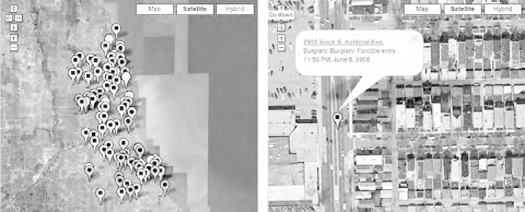
Typicalcrimemap,from
www.chicagocrime.org.
Criminalevents,notpeople,aremappedtothecity.
Search WWH ::

Custom Search