Geography Reference
In-Depth Information
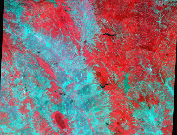
KOSOVO: SPOT 083-264, JUNE 3 AND JUNE 6, 1999
Kosovo, 1999—
Between March 22 and June 14, 1999, the commercial French SPOT
satellites aimed their sensors at sites in southeastern Europe seventy-two times, col-
lecting data on the ground from an altitude of 822 kilometers (511 miles). Thousands
of megabytes of data about war, displacement, and destruction, because—not by
accident—the satellites were passing over Kosovo. Their 10-meter and 20-meter res-
olution data were immediately stored and made available publically, directly from an
active war zone, on almost every day of the NATO air campaign.
Here are data sets from June 3 and June 6, two of the rare cloudless days during
the war, as the satellites recorded what was happening in the scenes below, gath -
ering information on the landscape of ethnic cleansing and war. Permanent digital
records, created at the speed of light: sixty square kilometers in a matter of seconds.
KOSOVO: SAT•K-J ID•DATE•TIME•CAMERA•SENSOR
SPOTscene:2•083-264•99/06/03/•09:18:53•2•X
Cloudcover:0%
Extents:11,938,066pixels
Topleft:43°01'12”N,20°39'55”E
Bottomright:42°23'40”N,21°23'02”E
Coverage:79.88x59.780kilometers
Resolution:1pixel=20meters
INCLUDES MATERIAL
©
1999 SPOT IMAGE. ALL RIGHTS RESERVED
Search WWH ::

Custom Search