Graphics Reference
In-Depth Information
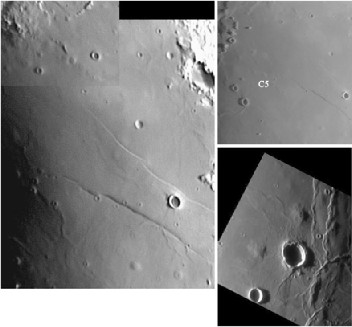
Fig. 8.21
(
a
) Telescopic CCD image of the northern part of Mare Tranquillitatis, showing the
dome field around the crater Cauchy and the NTA domes. (
b
) Telescopic CCD image of the
north-western part of Mare Tranquillitatis, showing further domes in the Cauchy region. (
c
) Tele-
scopic CCD image of the region around Arago. Image credit: P. Lazzarotti. North is
to the top
and
west
to the left
8.4.3 Image-Based Determination of Morphometric Data
This section describes the construction of DEMs of lunar domes, relying on tele-
scopic CCD images and also recent spacecraft images. An estimation of the error
interval of the morphometric parameters (e.g. the dome height) inferred from the
DEMs is performed, and the obtained dome heights are compared to other, inde-
pendently obtained height measurements. The description is mainly adopted from
Wöhler et al. (
2006b
) and also discusses results of further studies.
8.4.3.1 Construction of DEMs
A robust method for estimating elevation differences on the lunar surface is the anal-
ysis of shadow lengths as described in Sect.
3.1
. In the CCD images, the diameter
D


Search WWH ::

Custom Search