Geography Reference
In-Depth Information
70°E
80°E
90°E
100°E
110°E
120°E
130°E
140°E
50°N
50°N
Heilongjiang
Jilin
40°N
Inner Mongolia
40°N
Xinjiang
Liaoning
Beijing
Hebei
Gansu
Shanxi
Shandong
Ningxia
Qinghai
Shaanxi
Henan
30°N
Jiangsu
30°N
Tibet
Anhui
Shanghai
Hubei
Sichuan
Zhejiang
Chongqing
Jiangxi
Hunan
Guizhou
Fujian
Taiw an
Yunnan
20°N
Guangxi
Guangdong
20°N
Hainan
0
250
500
1,000
km
10°N
10°N
80°E
90°E
100°E
110°E
120°E
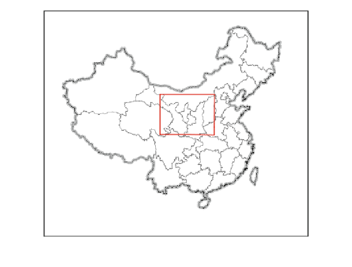
Fig. 5.4
Location of study area
may aggravate the seasonal drought in Jiangxi Province, while the expan-
sion of evergreen forests is more favorable since it may increase the annual
average precipitation in most part of Jiangxi Province.
(ii)
There are significant effects of afforestation, especially the deciduous forest
expansion, on the monthly average precipitation. There is only slight change
in the monthly average temperature caused by afforestation. What's more,
the deciduous forest expansion may result in severe drought at the local
scale in the summer in Jiangxi Province.
5.2 Projection of the Biogeophysical Effects of Green
for Grain Project in the Semiarid Grassland Area
Loess Plateau is mainly located in the arid and semiarid area of China with a
fragile ecological environment (Fig.
5.4
). Poor land use practices have resulted in
the serious soil erosion, land degradation, desertification, and deterioration of the
ecological environment (Clarke
2000
). To speed up the construction of ecological
environment in Western China, the government had implemented the project of
Green for Grain, which has achieved desirable results. It not only prevents the soil
erosion and ecological environment degradation effectively, but also promotes the
development of grass industry, animal husbandry, and agriculture industries after
the policy is implemented comprehensively (Kang
1985
). However, when we are