Geography Reference
In-Depth Information
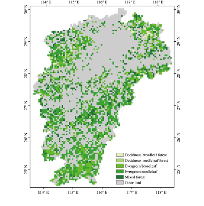
Fig. 5.1
Forest area of Jiangxi Province in 2000
statistical results of the underlying surface data suggest that more than 40 % are
covered by the forests (2,717 pixels) in Jiangxi Province (Fig.
5.1
), and about
30 % of them were covered by the broadleaf forests, while the needleleaf forests
accounted for more than 52 % of the total forestry area.
The underlying surface data under the DB, DN, EB, and EN scenarios are
generated by replacing all the forests with one specific type of forests, respectively.
For instance, the underlying surface data under the DB scenario was generated by
replacing all the forestry area by the deciduous broadleaf forests, and consequently
all the forestry area in Jiangxi Province is covered by the deciduous broadleaf
forests under the scenario of BD. And similarly, the underlying surface data of DN,
EB, and EN were generated by altering the property of pixels.