Geoscience Reference
In-Depth Information
The results show that the spatial organization of neighborhoods is influenced
rather by the historical context or underlying urban planning concepts which
contributed to its emergence. These conditions may be comparable for neighbor-
hoods belonging to different cities or countries. Hence, the resemblances between
neighborhoods of different cities may be greater than those observed within a city.
2.5.3
The Multiradial Approach
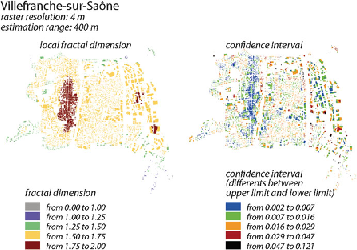
Very recently, we have tested a specific method in order to segment town sections on
the basis of their spatial organization. For this purpose, we realized radial analyses
for each built-up site and estimated the fractal dimension within a fixed distance
range, e.g., 400 m around the counting point. We then introduced classes of fractal
dimensions. Figure
2.8
shows an example for a city near Lyon. It clearly turns out
that the entire core of the old center has the same high-dimension values, in keeping
with their rather homogenous shape. Around this, the more recent town sections are
more contrasted and have lower dimensions. The fringes where non-built areas come
into play have lower dimensions still. The quality of adjustment is here checked by
means of the confidence interval. This indicator is rather sensitive to local changes in
spatial organization. The range becomes larger, e.g., in the vicinity of a big building
Fig. 2.8
Multiradial analysis (French topographic map)
Search WWH ::

Custom Search