Geoscience Reference
In-Depth Information
Hurricane Center (NHC) Advisory Archive for Hurricane Sandy (NOAA
2013a
)
track data and meteorological conditions (e.g., central pressure, forward speed, and
radius to maximum wind).
To simulate the Hurricane Sandy storm surge, a simulation was run for October
18th until the 28th including tides (tidal potential components M2, S2, N2, K2,
K1, O1, and Q1) but neglecting river inflows. The simulations were performed
under the HPC environment provided by the Extreme Science and Engineering
Discovery Environment (XSEDE) supported by the National Science Foundation
(NSF). Results were recorded every 15 min around the study region at every model
node and at NOAA Tides and Currents stations (NOAA
2013b
). The model results
generally overestimate the measured water levels most likely due to the differences
between the hypothetical asymmetrical wind and pressure fields and the actual storm
conditions.
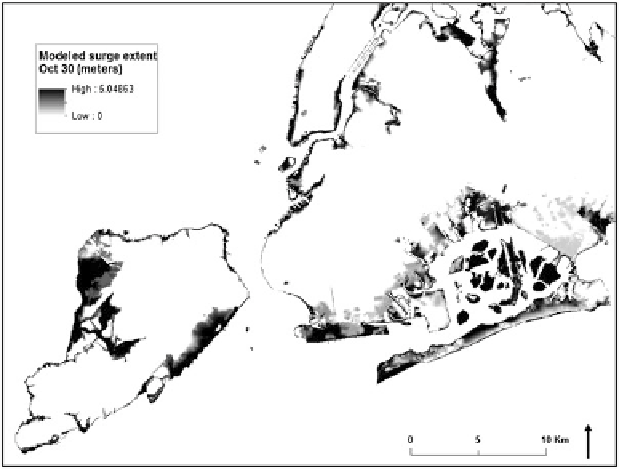
The spatial flood levels were calculated using a Digital Elevation Model (DEM)
with a 1 arc-second resolution from the National Elevation Dataset (NED) for the
study region (USGS
2013
). The maximum water levels for each model node were
extracted for the 29th and the 30th of November and converted to the NAVD88
vertical datum. A spline interpolation with tension was applied to create a maximum
water level surface for the study region according to the methodology suggested by
Berenbrok et al. (
2009
). Finally, the water levels were subtracted from the DEM to
calculate the spatial flooded extent (Fig.
14.2
).
Fig. 14.2
Modeled surge extent for October 30 at 1:00pm
Search WWH ::

Custom Search