Geoscience Reference
In-Depth Information
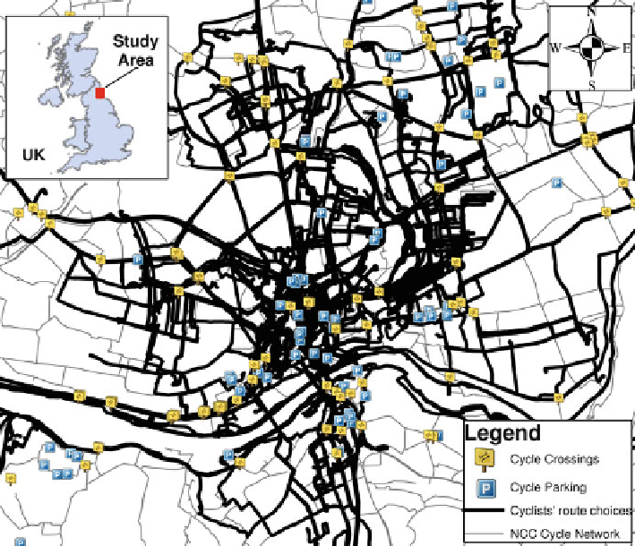
Fig. 8.2
Map of study area with cyclists' route choices and cycle infrastructure data
were more flexible but constrained to the northeast region of England. Taking this
approach allowed the spatial characteristics of the primary sample to reflect the
spatial dynamics identified prior to the primary data collection. Figure
8.2
shows
the study area with cyclists' route choices and cycle infrastructure data. The left
side shows the major transport networks which appear to have its major hub around
Newcastle Central Rail Station.
8.4
Methods Used in This Study
8.4.1
Data Collection, Processing, and Sample Characteristics
8.4.1.1
Survey Instruments
Three survey instruments were developed, in addition to the use of GPS devices
and materials for the field campaign. Four GPS devices were evaluated and QStarz
Search WWH ::

Custom Search