Geography Reference
In-Depth Information
The equidistant mapping of the sphere to the tangen-
tial plane at the North Pole is associated with the name
of G. Postel (1510-1581), though it was already known
to
Mercator
(
1569
). Both used it for mapping the polar
regions. Nowadays, it is applied for plotting stars around
the North Pole, for the World Map 1:2.5 Mio, and for charts
in aerial navigation, remote sensing, and seismology.
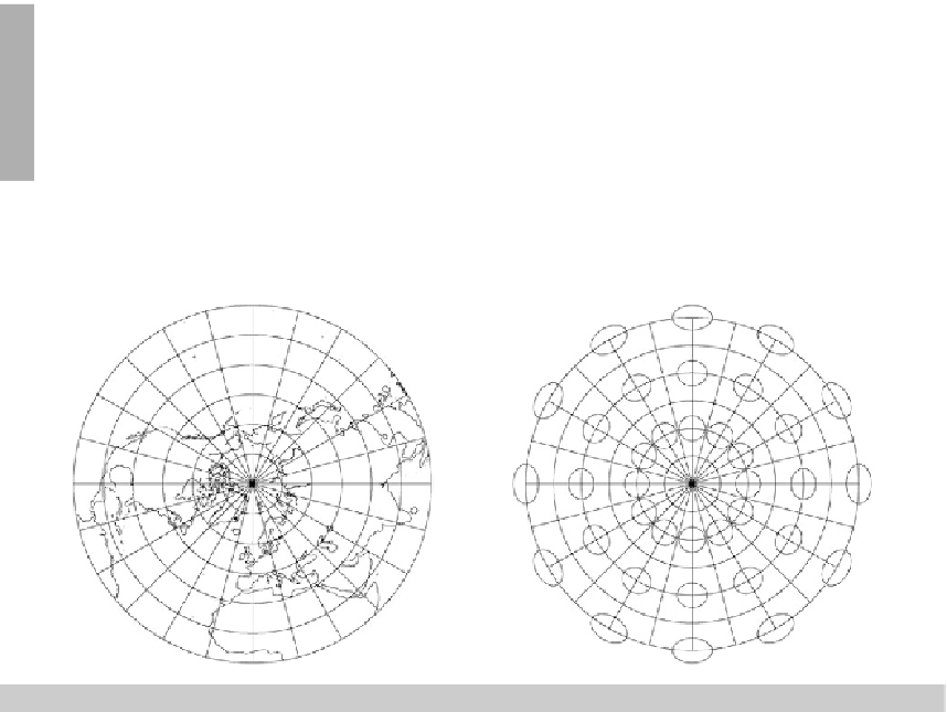
In order to complete the considerations, we present to you Fig.
5.5
, which shows a sample of a
polar equidistant map of the sphere.
S
2
R
onto the tangent space
T
N
S
2
R
, Tissot ellipses, polar aspect,
Fig. 5.5.
An equidistant mapping of the sphere
graticule 15
◦
, shorelines
5-22 Conformal Mapping (Stereographic Projection, UPS)
Let us postulate a
conformal mapping
by means of the canonical measure of conformality, i.e.
Λ
1
=
Λ
2
. Such a conformal mapping of the sphere to the tangential plane of the North Pole is
illustrated by means of Fig.
5.6
that follows after the Boxes
5.4
and
5.5
.
Question 1: “How can we generate the conformal map-
ping equations?” Answer 1: “Following the procedure of
Boxes
5.4
and
5.5
, we here depart from the general repre-
sentation of
Λ
1
and
Λ
2
. By means of separation of variables,
the relation
Λ
1
=
Λ
2
leadsustod
f/f
=d
Δ/
sin
Δ
as the
characteristic differential equations. Integration of the left
side as well as of the right side leads us to the indefinite
mapping equation
f
(
Δ
)=
c
tan
Δ/
2.”

Search WWH ::

Custom Search