Geography Reference
In-Depth Information
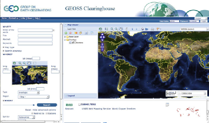
Fig. 18.3
Web GUI of GEOSS clearinghouse
18.3.3
Data Access and User Interaction
The GEOSS clearinghouse provides geospatial datasets and resources through
both local (Fig.
18.3
) and remote interfaces. For local interface, users access
big data through the GEOSS clearinghouse portal, which provides a simple and
easy-understanding search interface. Users can search metadata based on the title,
keywords, any text, spatial bounding box and so on. In addition, users can access
data according to the data category. For remote interface, the GEOSS clearinghouse
supports various protocols for domain users to search geospatial datasets through
CSW, SRU, RSS and other standard interfaces. After the search process, discovered
results will be shown on a result page. The result page supports different sorting
rules (relevance, Date, title alphabetical order, popularity, and rate). Icons are used
to tag provider through a thumbnail. The buttons for access tools are dynamically
added to each record panel according to resource types. The original metadata file
can be accessed through the supper link for the domain user. Users can also interact
with integrated visualization tools for viewing data services. This integrated tool is
supported by OpenLayer (
2012
).
18.3.4
Challenges and Computing Demands
To address the spatiotemporal data management challenges, metadata is used
in GEOSS clearinghouse to describe data; a spatiotemporal index with high
Search WWH ::

Custom Search