Geography Reference
In-Depth Information
10.5
Case Study: Tornadoes in Oklahoma,
US, April 14-16, 2012
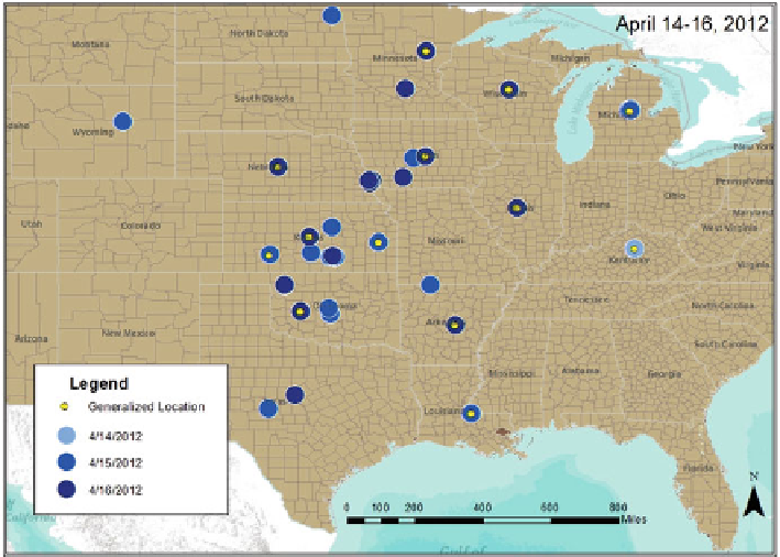
The dataset for this case study includes Web news reports on tornadoes that ravaged
a large portion of the US Midwest, especially Oklahoma, during April 2012. Articles
about this event published from April 14 to April 16 have been obtained from
http://
www.cnn.com/
and processed for their spatial, temporal and semantic content.
10.5.1
Combining Spatiotemporal Information
Each document in the dataset includes a header giving the published date of
the article and temporal information is extracted using GATE, allowing locations
retrieved from the text to be ordered according to different document dates (i.e.,
April 14-16). A map shows a portion of the central United States and the Great
Lakes region that were impacted by the tornadoes with the highest number of events
occurring in Kansas (Fig.
10.3
). Currently, for generalized geographic references,
such as states, counties, and regional geographic places, geocoding is handled by
selecting a central point of reference. In this case study, these types of locations
Fig. 10.3
Locations automatically extracted from news documents about tornadoes that struck
Oklahoma, US in April 2012
Search WWH ::

Custom Search