Geology Reference
In-Depth Information
Another consequence of plate interactions in this region
was the westward movement of the North American plate
and its collision with the Pacifi c-Farallon ridge. Because the
Pacifi c-Farallon ridge was oriented at an angle to the margin
of North America, the continent-ridge collision took place
fi rst during the Eocene in northern Canada and only later
during the Oligocene in southern California (Figure 23.9). In
southern California, two triple junctions formed, one at the
intersection of the North American, Juan de Fuca, and Pacifi c
plates, the other at the intersection of the North American,
Cocos, and Pacifi c plates. Continued westward movement of
the North American plate over the Pacifi c plate caused the
triple junctions to migrate, one to the north and the other
to the south, giving rise to the
San Andreas transform fault
(Figure 23.9). A similar occurrence along Canada's west coast
produced the
Queen Charlotte transform fault.
Seismic activity on the San Andreas fault results from
continuing movements of the Pacifi c and North American
plates along this complex zone of shattered rocks. Indeed,
where the fault cuts through coastal California, it is actually
a zone as much as 2 km wide, and it has numerous branches.
Movements on such complex fault systems subject blocks of
rocks adjacent to and within the fault zone to extensional
and compressive stresses, forming basins and elevated ar-
eas, the latter supplying sediments to the former. Many of
the fault-bounded basins in the southern California area
subsided below sea level and soon fi lled with turbidites and
other deposits. A number of these basins are areas of prolifi c
oil and gas production.
Figure 23.4 shows that much of central North America is
a vast area called the
Interior Lowlands
, which in turn are
made up of the
Great Plains
and the
Central Lowlands.
Dur-
ing the Cretaceous, the Great Plains were covered by the
Zuni
epeiric sea
, but by Early Paleogene time, this sea had largely
withdrawn except for a sizable remnant that remained in
North Dakota. Sediments eroded from the Laramide high-
lands were transported to this sea and were deposited in
transitional and marine environments (
Figure 23.10).
The only local sediment source within the Great Plains
was the Black Hills in South Dakota. This area has a his-
tory of marine deposition during the Cretaceous, followed
by the origin of terrestrial deposits derived from the Black
Hills that are now well exposed in Badlands National Park,
South Dakota. Judging from the sedimentary rocks and
their numerous fossil mammals and other animals, the area
was initially covered by semitropical forest, but grasslands
replaced the forests as the climate became more arid.
Igneous activity was not widespread in the Interior Low-
lands, but was signifi cant in some parts of the Great Plains.
For instance, igneous activity in northeastern New Mexico
was responsible for volcanoes and numerous lava fl ows, and
several small plutons were emplaced in Colorado, Wyoming,
Montana, South Dakota, and New Mexico. Indeed, one of the
most widely recognized igneous bodies in the entire conti-
nent, Devils Tower in northeastern Wyoming, is probably an
Eocene volcanic neck, although some geologists think that it
◗
◗
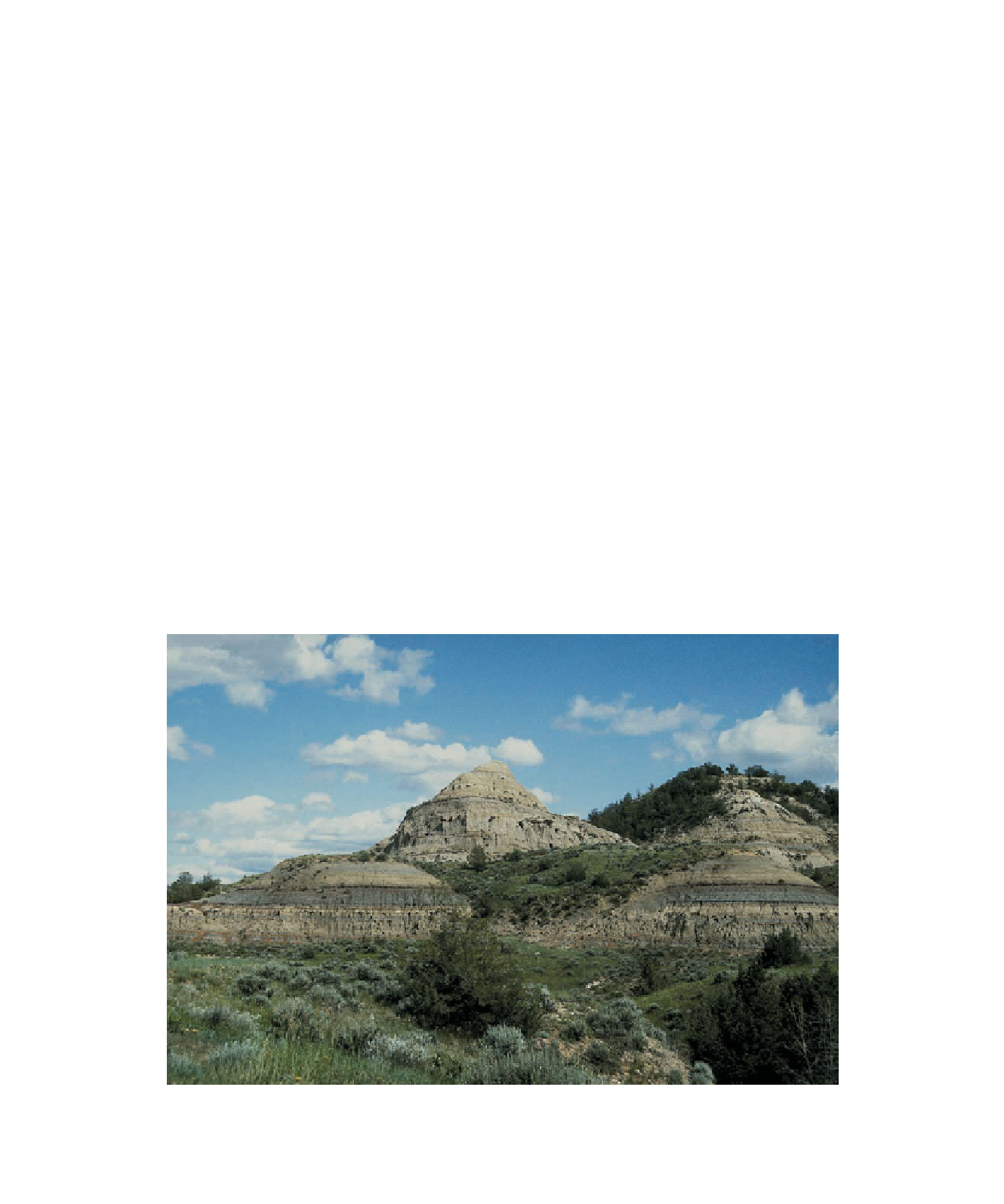
Figure 23.10
Paleocene Sedimentary Rocks Vast amounts of sediment shed from the Laramide
Highlands were deposited on the Great Plains. These Paleocene sedimentary rocks are exposed in
Theodore Roosevelt National Park in North Dakota.
Search WWH ::

Custom Search