Geology Reference
In-Depth Information
basins constantly changes. One
of the goals of historical geology
is to provide paleogeographic
reconstructions of the world
during the geologic past. By
synthesizing all of the pertinent
paleoclimatic, paleomagnetic,
paleontologic, sedimentologic,
stratigraphic, and tectonic data
available, geologists can con-
struct paleogeographic maps.
Such maps are simply interpreta-
tions of the geography of an area
for a particular time in the geo-
logic past and usually show the
distribution of land and sea, pos-
sible climatic regimes, and such
geographic features as mountain
ranges, swamps, and glaciers.
The paleogeographic history
of the Paleozoic Era, for example,
is not as precisely known as that of
the Mesozoic and Cenozoic eras, in
part because the magnetic anomaly
patterns preserved in the oceanic
crust were destroyed when much
of the Paleozoic oceanic crust was
subducted during the formation
of Pangaea. Paleozoic paleogeo-
graphic reconstructions are there-
fore based primarily on structural
relationships, climate-sensitive
sediments such as red beds, evapo-
rites, and coals, as well as the distri-
bution of plants and animals.
At the beginning of the Paleozoic, six major conti-
nents were present. Besides these large landmasses, geolo-
gists have also identifi ed numerous microcontinents, such
as
Avalonia
(composed of parts of present-day Belgium,
northern France, England, Wales, Ireland, the Maritime
Provinces and Newfoundland of Canada, as well as parts
of the New England area of the United States), and various
island arcs associated with microplates. We are primarily
concerned, however, with the history of the six major conti-
nents and their relationships to one another. The six major
Paleozoic continents are
Baltica
(Russia west of the Ural
Mountains and the major part of northern Europe),
China
(a complex area consisting of at least three Paleozoic conti-
nents that were not widely separated and are here consid-
ered to include China, Indochina, and the Malay Peninsula),
Gondwana
(Africa, Antarctica, Australia, Florida, India, Mad-
agascar, and parts of the Middle East and southern Europe),
Kazakhstania
(a triangular continent centered on Kazakh-
stan but considered by some to be an extension of the
Paleozoic Siberian continent),
Laurentia
(most of present-
day North America, Greenland, northwestern Ireland, and
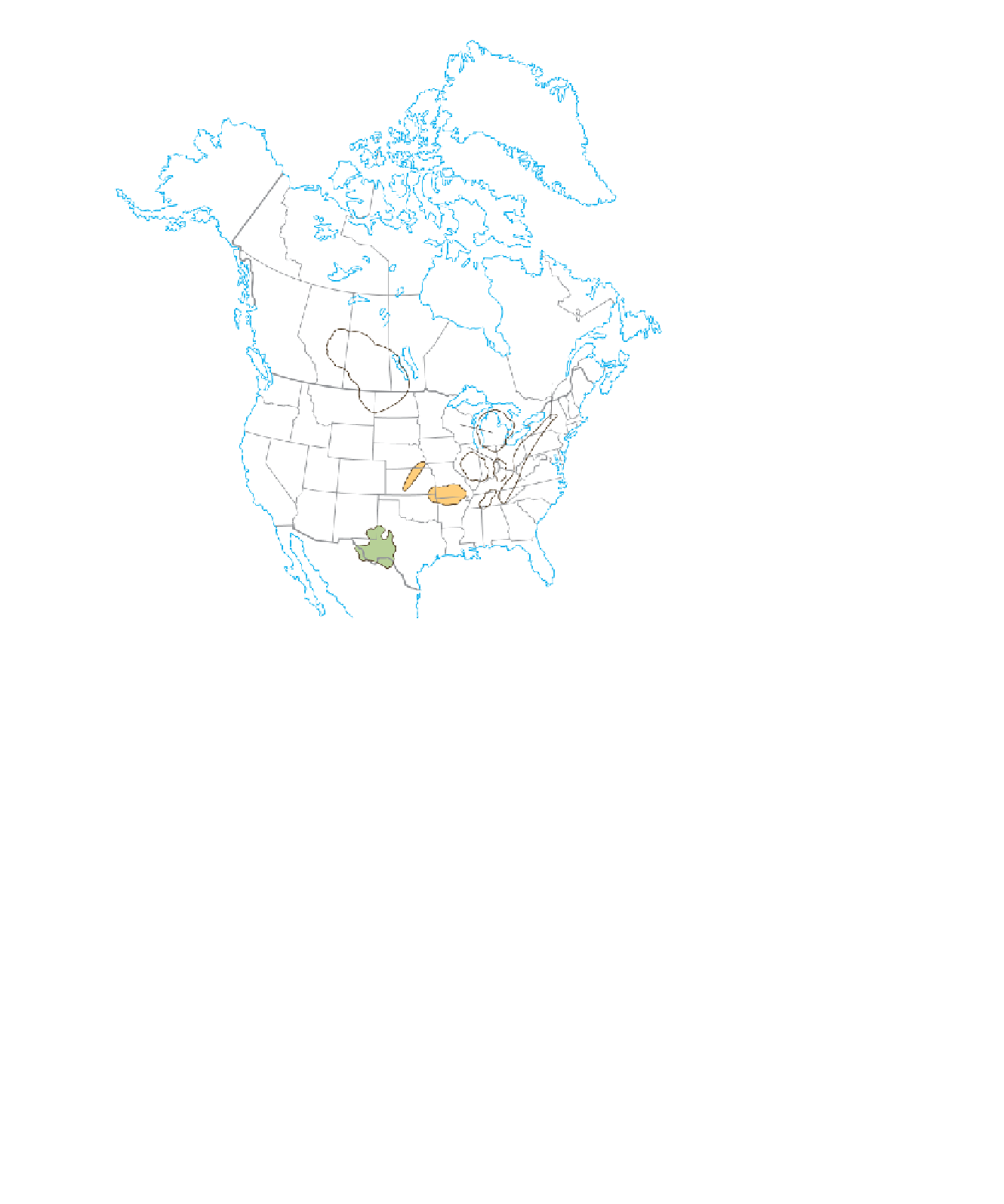
Franklin
mobile
belt
Canadian
Shield
Williston
Basin
Appalachian
Basin
Michigan Basin
Cincinnati Arch
Illinois Basin
Nemaha Ridge
Platform
Ozark Dome
Nashville
Dome
Permian
Basin
Ouachita
mobile
belt
◗
Figure 20.1
Major Cratonic Structures and Mobile Belts The major cratonic structures
and mobile belts of North America that formed during the Paleozoic Era.
Mobile belts
are elongated areas of mountain-building
activity. They are located along the margins of continents
where sediments are deposited in the relatively shallow
waters of the continental shelf and the deeper waters at the
base of the continental slope. During plate convergence along
these margins, the sediments are deformed and intruded by
magma, creating mountain ranges.
Four mobile belts formed around the margin of the
North American craton during the Paleozoic: the
Frank-
lin, Cordilleran, Ouachita
, and
Appalachian mobile belts
(Figure 20.1). Each was the site of mountain building in
response to compressional forces along a convergent plate
boundary and formed mountain ranges such as the Appala-
chians and Ouachitas.
One result of plate tectonics is that Earth's geography is
constantly changing. The present-day confi guration of the
continents and ocean basins is merely a snapshot in time. As
the plates move about, the location of continents and ocean


Search WWH ::

Custom Search