Geology Reference
In-Depth Information
◗
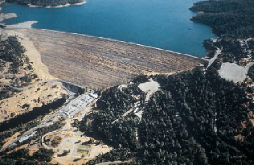
Figure 12.17
Flood Control Dams and reservoirs, levees, fl oodways, and fl oodwalls are some of the
structures used to control fl oods.
Oroville Dam in California, at 235 m high, is the highest dam
in the United States. It helps control fl oods, provides water for
irrigation, and produces electricity at its power plant.
a
This levee, an artifi cial embankment along a waterway, helps
protect nearby areas from fl oods. A university campus lies out of
view just to the right of the levee.
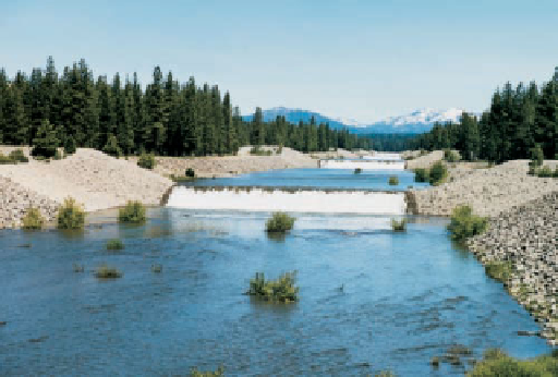
b
This fl oodway carries excess water from a river (not visible)
around a small community.
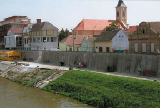
This fl oodwall on the bank of the Danube River at Mohács,
Hungary, helps protect the city from fl oods.
c
d
tributaries—that is, streams that contribute water to another
stream. The Mississippi River and its tributaries such as the
Ohio, Missouri, Arkansas, and Red rivers and thousands of
smaller ones, or any other drainage system for that mat-
ter, carry runoff from an area known as a
drainage basin
.
A topographically high area called a
divide
separates a
drainage basin from adjoining ones (
In dendritic drainage, tributaries join larger channels
at various angles, but
rectangular drainage
is characterized
by right-angle bends and tributaries joining larger channels
at right angles (Figure 12.19b). Such regularity in channels
is strongly controlled by geologic structures, particularly
regional joint systems that intersect at right angles.
Trellis drainage
, consisting of a network of nearly parallel
main streams with tributaries joining them at right angles,
is common in some parts of the eastern United States. In
Virginia and Pennsylvania, erosion of folded sedimentary
rocks developed a landscape of alternating ridges on resis-
tant rocks and valleys underlain by easily eroded rocks. Main
waterways follow the valleys, and short tributaries fl owing
from the nearby ridges join the main channels at nearly right
angles (Figure 12.19c).
In
radial drainage
, streams fl ow outward in all direc-
tions from a central high point, such as a large volcano
(Figure 12.19d). Many of the volcanoes in the Cascade
Figure 12.18). The
continental divide along the crest of the Rocky Mountains in
North America, for instance, separates drainage in opposite
directions; drainage to the west goes to the Pacifi c, whereas
drainage to the east eventually reaches the Gulf of Mexico.
The arrangements of channels within an area are classifi ed
as types of
drainage patterns.
The most common is
dendritic
drainage
, which consists of a network of channels resembling
tree branching (
◗
Figure 12.19a). It develops on gently slop-
ing surfaces composed of materials that respond more or less
homogeneously to erosion, such as areas underlain by nearly
horizontal sedimentary rocks.
◗


Search WWH ::

Custom Search