Geology Reference
In-Depth Information
◗
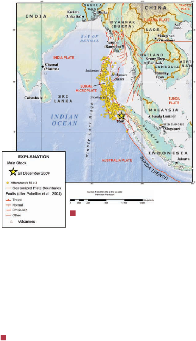
Figure 8.16
2004 Indian Ocean Tsunami
The magnitude-9.0 earthquake off the coast of
northwest Sumatra in December 2004 generated a
devastating tsunami throughout the Indian Ocean.
Map showing the epicenter of the earthquake
and its aftershocks equal to or greater than
magnitude 4.
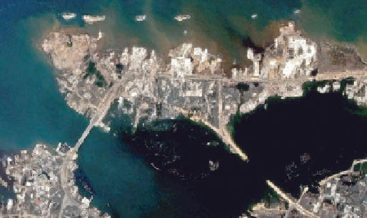
a
c
A similar satellite image of the same area on December
28, 2004, two days after the tsunami struck. Notice the total
destruction of all the buildings and one bridge.
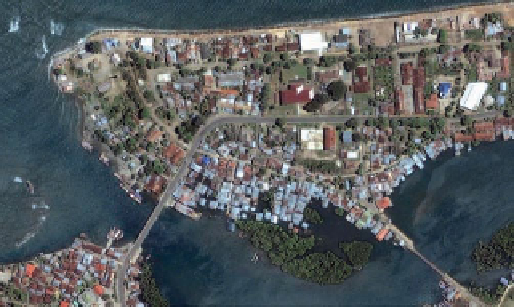
b
Satellite image of the north shore of Banda Aceh, the capital
city of Aceh Provence, Sumatra, Indonesia, taken on June 23,
2004.
Earthquake-triggered landslides are particularly dangerous
in mountainous regions and have been responsible for tre-
mendous amounts of damage and many deaths. The 1959
earthquake in Madison Canyon, Montana, for example,
caused a huge rock slide (
is determined, and instruments are checked to see whether a
tsunami has been generated. If it has, a warning is sent out to
evacuate people from low-lying areas that may be affected.
Nevertheless, tsunami remain a threat to people in
coastal areas, especially around the Pacifi c Ocean (Table 8.4).
Unfortunately, no such warning system exists for the Indian
Ocean. If one had been in place, it is possible that the death
toll from the December 26, 2004 tsunami would have been
signifi cantly lower.
Figure 8.17), and the 1970 Peru
earthquake caused an avalanche that destroyed the town of
Yungay and killed an estimated 66,000 people. Most of the
◗

Search WWH ::

Custom Search