Geology Reference
In-Depth Information
Geo-inSight
The San Andreas Fault
California's north coast. In plate tectonic terminology, it marks
a transform plate boundary between the North American and
Pacific plates (see Chapter 2).
Earthquakes along the San Andreas and related faults will
continue to occur. But other segments of the circum-Pacific
belt, as well as the Mediterranean-Asiatic belt, are also quite
active and will continue to experience earthquakes.
The circum-Pacific belt is well known for its volcanic activity
and earthquakes. Indeed, about 60% of all volcanic eruptions
and 80% of all earthquakes take place in this belt that nearly
encircles the Pacific Ocean basin (Figure 8.4).
One well-known and well-studied segment of the
circum-Pacific belt is the 1300-km-long San Andreas fault
extending from the Gulf of California north through coastal
California until it terminates at the Mendocino fracture zone off
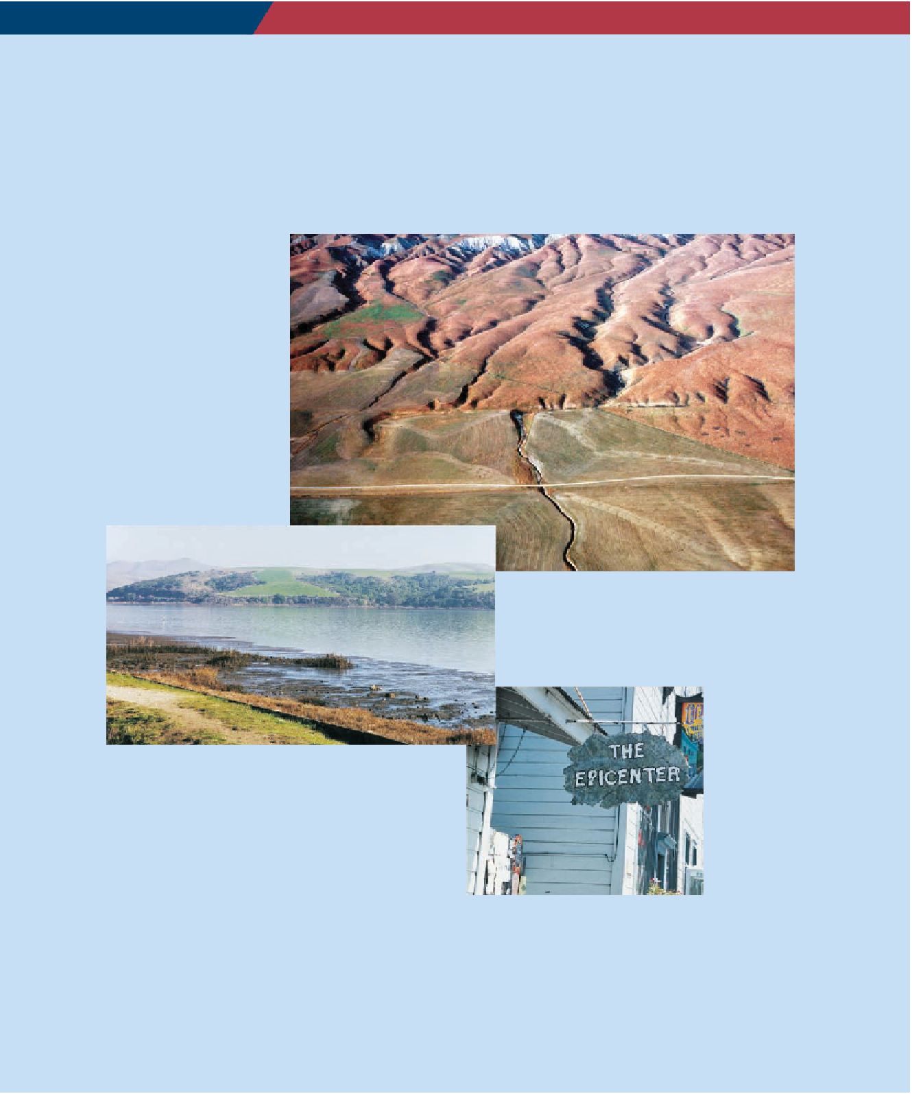
1. Aerial view of the San Andreas fault.
2. View across the San Andreas fault at Tomales Bay,
north of San Francisco. The low area occupied by the bay
is underlain by shattered rocks of the San Andreas fault
zone. Rocks underlying the hills in the distance are on the
North American plate, whereas those at the point where
this photograph was taken are on the Pacific plate.
3. This shop in Olema, California, is rather
whimsically called The Epicenter, alluding to
the fact that it is in the San Andreas fault
zone.
204
Search WWH ::

Custom Search