Geoscience Reference
In-Depth Information
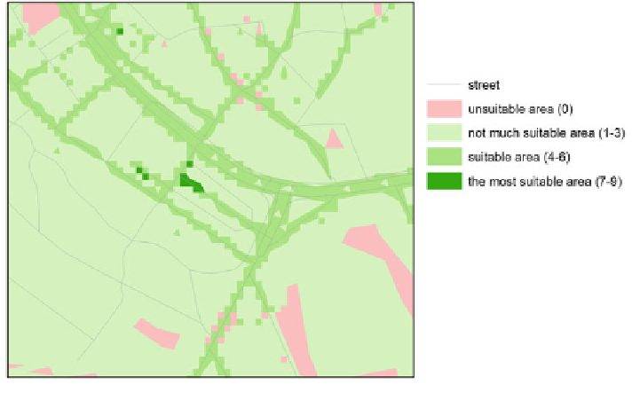
Fig. 1 Part of the raster of suitable areas
4 Network Analyses
Extension Network Analyst for ArcGIS was used for the next steps of analysis. The
data structure
Network dataset was based on feature class street line (contains also
pavements). Network dataset is necessary for next network analyses.
—
4.1 Minimize Facilities Analysis
Analysis Minimize Facilities solves the minimal number of stations. The principle
is to localize facilities to allocate to them the maximum of demand points in
speci
9 were taken as
candidate points. Weight was taken from raster of suitable areas. The interval was a
crucial decision. There were only 15 address points in interval 7
ed distance. Address points with the weight in interval 5
-
-
9 (the most
suitable area) and 263 points in interval 6
9. Small number of candidate points
produces all points as result facilities [
12
]. The better choice was interval 5
-
9. Total
number of candidate points was 1,663 address points. Search tolerance was set to
200 m [
8
]. The input parameter is also impedance in minutes. Two values were set:
3 and 4 min for two runs of analysis. The result was only the number of station, not
their localisation. Quantities were 87 stations for 3 min and 43 for 4 min. The
quantities are very different in case of small change of time.
-
Search WWH ::

Custom Search