Geoscience Reference
In-Depth Information
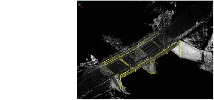
Fig. 3 Sample of a road
bridge surveying (Courtesy
GEOVAP Pardubice Ltd)
(d) Methods of terrestrial static laser scanning represent suitable methods for
operative and precise surveying of partial source materials for designing
activities of selected transportation objects (e.g. probably crossing of designed
construction with existing bridges, tunnels, supporting walls, noise protection
barriers). In connection with the aerial and terrestrial mobile laser scanning,
the methods enable complex surveying of existing transportation facilities,
which are supposed to in
uence the future construction or to utilize it. The
RMSE elevation of these methods is e.g. at the bridge surveying utilizing
phase laser scanners with range of 20
fl
—
-
50 m, 0.005 m
see [
5
] (Fig.
3
).
3 Results and Discussions
Point clouds received by both correlation methods from stereoscopic photographs
(or by direct stereoscopic measuring by an operator) and laser scanning methods
(mainly by mobile terrestrial laser scanning) can also be utilized in connection with
an orthophotomap with ground sample distance of 2.5 cm for creating various types
of visualizations and animations above a real landscape. The data can be used for
simulations of various vehicle movements. Such a view and simulation can reveal
potential future danger sections and suggest and design with utilizing real data a
safe, economically optimal and ecologically acceptable road and thus exploit all
features of the digital terrain models, which can currently be utilized by above
mentioned methods (Table
1
).
Search WWH ::

Custom Search