Geoscience Reference
In-Depth Information
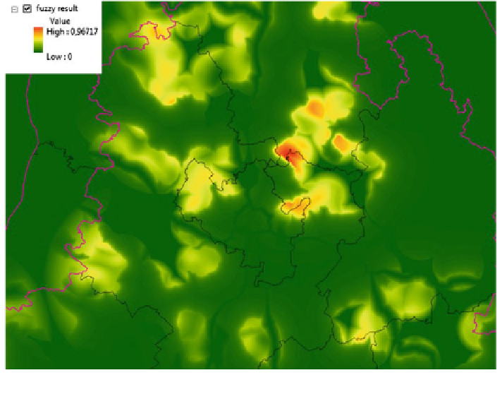
Fig. 8 The result of analysis near Brno and surrounding
—
fuzzy sets
the data reclassi
cation and eventually euclidean distance are computed. Finally we
can implement the raster operations to progressive evaluation of result according to
desired expression written as (Fig.
7
)
Ea
\
Fa
\
Bv
\
Ro
\
Hm
\
Bt
[
Ht
ð
Þ
Our intent of this spatial model was to represent a base map for analysis of
tourism regions in South Moravia. Final fuzzy map (Fig.
8
) depends on the
expression and description of the problem, determination of particular criteria and
assignment of the degree of membership to fuzzy sets. It is important to specify
operations on fuzzy sets (in this case standard intersection and union). The data
quality is essential.
6.2 Conclusion
This multicriteria decision analysis carries the obtaining of the basic spatial
placement of signi
cant tourist areas. It provides the results determined to compare
with statistical data such as the attendance and the attractiveness of region, the
substantiation of the low attendance in some places,
finding their developing,
linkup to public services and the direct consequences for hiking and bike trails.
Search WWH ::

Custom Search