Geoscience Reference
In-Depth Information
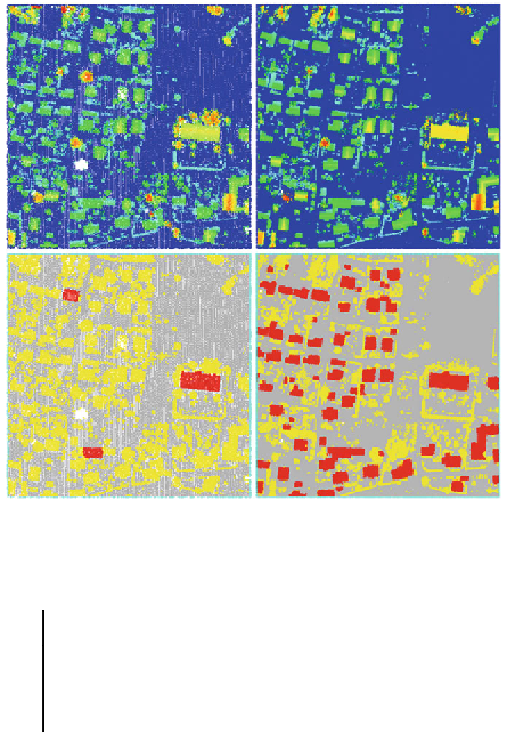
Fig. 3 Datasets: #1
—
Czech Land Survey Office [left] and #2
—
Krkono
š
e Mountains National
Park [right]. Top Raw point clouds (colour hypsometry in relation to the height of the terrain).
Bottom Classified point clouds: terrain (gray), buildings (red), other (yellow), unprocessed (cyan)
dataset N
o
Table 1 Comparison of input data; #
—
#
Owner of data
Area
Average density
(p/m
2
)
1
Czech Land Survey Of
ce
Rokytnice nad Jizerou
(Czech Republic)
1.2
2
Krkono
e Mountains
National Park
Rokytnice nad Jizerou
(Czech Republic)
8.2
š
3
ENVI LiDAR sample data
Kleinwolkersdorf (Austria)
21.8
geometric primitives by interleaving planes through the point cloud. The software
interleaves planes exclusively from the points that were classi
ed into the class
buildings. This approach reduces the amount of data that must be analyzed (Fig.
5
).


Search WWH ::

Custom Search