Geoscience Reference
In-Depth Information
tridicon CityModeller allow the generation of 3D building models from point
clouds and building footprints. Tridicon BuildingFinder generates building foot-
prints and 3D buildings only from oriented aerial images. These software products
have not yet been tested.
4 ENVI LiDAR
ENVI LiDAR (E3De in the past, further only the software) comes from Exelis VIS
(Visual Information Solutions) that focuses on the development of software prod-
ucts for analysis and visualization of geo-information. A trial version of the soft-
ware (version 3.2, January 2013) was obtained from the company ARCDATA
PRAHA s.r.o., which is a distributor of Exelis VIS products for the Czech Republic.
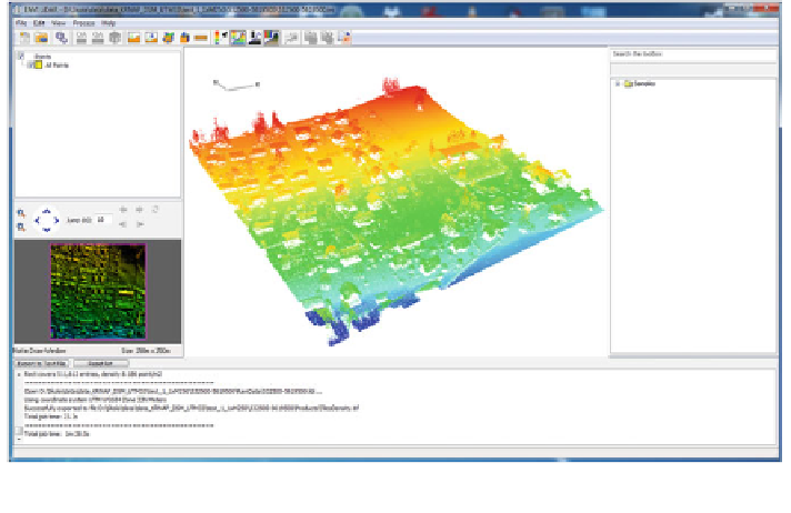
The software is designed for automatic processing and interactive control of
ALS data (Fig.
2
). The result of processing is a classi
cation of raw point cloud into
several classes (terrain, buildings, trees, power lines and poles). Classi
ed data can
be used for the creation of elevation models (DTM and DSM) and 3D models of
buildings and vegetation that can be exported and used in other software products.
Input data can be in binary format LAS (LiDAR/Laser data exchange format) or
ASCII. The software enables you to work with the georeferenced data in any
projection and geodetic datum. The recommended density of the point cloud is
greater than 1
2 points per square meter. The data processing runs completely
automatically without the need of human intervention. The setup processing is done
in the only dialog window with three tabs.
-
Fig. 2 Interface of the software and visualization of raw point cloud (colour hypsometry,
perspective view)
Search WWH ::

Custom Search