Geoscience Reference
In-Depth Information
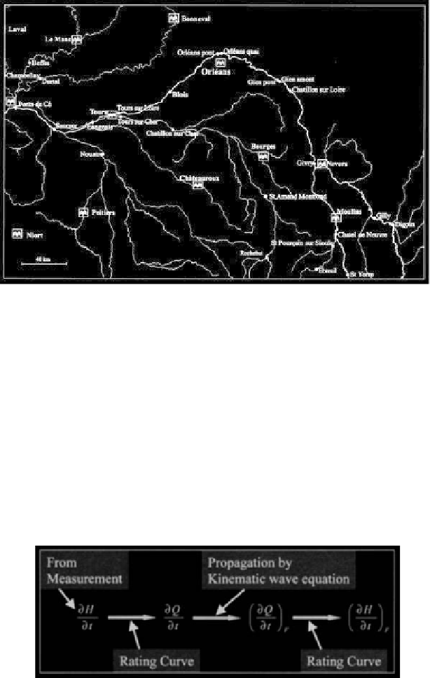
Figure 6.2.
Loire River and its tributaries
6.1.1
Description of the model
The model under consideration forecasts water levels and discharges at a point using the
water levels observed at certain points upstream of the river course. The basic steps
involved in implementing the model are (i) the measurement of water levels at upstream
stations, (ii) the estimation of discharges from the water levels, (iii) the propagation of
flow to downstream stations, and (iv) the conversion of discharges to forecast water
levels. The conversion from water level to discharge and
vice versa
is carried out using
pre-established stage-discharge relationships (rating curves). A schematic diagram
showing the processes involved in the model is presented in Figure 6.3.
Figure 6.3.
Schematic representation of the Loire River flood forecasting
model. The subscript
F
represents forecasts.
The wave propagation step is based on the kinematic wave approximation, that is, the
discharge is assumed to propagate downstream according to:
Search WWH ::

Custom Search