Geoscience Reference
In-Depth Information
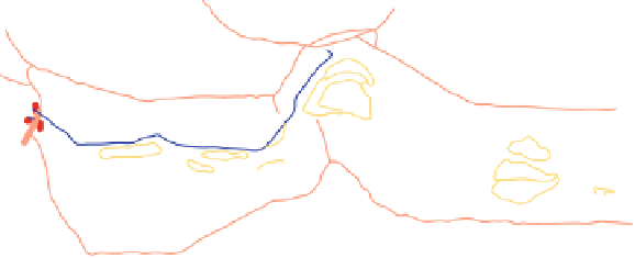
TO SAMASTIPUR
NEW LINE
MANSI
NARAYANPUR R.S.
SIMARIAGHAT
R.S
TO
KATIHAR
MONGHYR
R.S
MONGHYR
C.L. GANGA
BRIDGE
DHARAHARA
R.S
TO
SAHEBGANJ
BHAGALPUR R.S.
Fig. 5.2
Index plan showing Ganga river near Mansi railway station
Between Maniharighat and Rajmahal, the right bank is restricted by Rajmahal hill
outcrops; the flood-plain spreads only on the left. The river swung southeast from
near Rajmahal up to the confluence of Mora Kosi (dead Kosi) which joins the
Fulahar near Bhutni Diara island in West Bengal on the left. It flows almost straight
up to the confluence of the Fulahar, just below the island. Further down, it swung left
at Manikchak in Maldah district of West Bengal and heavily eroded the left bank.
Braiding and meandering continued and formed alluvial fans on the right. At some
places, it has been bifurcated by point-bars in mid-stream, severely eroding the left
bank. Erosion continued for about 35 km, from Manikchak to Farakka on the left,
creating alluvial fans by soft deposits. Though the deep channel swings within the
dominant waterway in the stretch, it is mostly located on the left side of the river
and at some places, very close to the left bank which accelerates erosion. Alluvial
fans continue on the right up to Farakka while the deep channel hugs the left bank
(Fig. 5.3).
Human interference in any river, like navigation, transportation, irrigation, power
generation, drinking water availability etc. has been the same in the Ganga too. The
most important interference has been made at Farakka in West Bengal, where a
barrage has been constructed mainly to partly divert its water to the Bhagirathi-
Hooghly to rejuvenate it. Its benefits are being availed not only by India but by two
Himalayan countries too - Nepal and Bhutan - but it has affected the morphology of
the river, both up and down stream. It is very difficult for an alluvial river to remain
both dynamic and stable and maintain its equilibrium in geological time. Such a
stream retains this state if its discharge, sediment-load, size and bed slope are bal-
anced. A change in any of these, or construction of a structure along, or across, is
likely to disturb this equilibrium and aggrade, degrade or change its course. This
continues for a long time till a new equilibrium is established. This is very impor-
tant from engineering point of view too, as they both occupy considerable space
and time. Owing to excessive aggradation, i.e., rise in the river-bed, the flood-level
increases but the capacity of the channel decreases. Because of the latter, the channel


Search WWH ::

Custom Search