Geology Reference
In-Depth Information
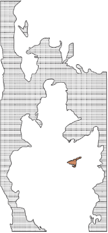
N
Key
Fortaleza complex
Diorite
Basic
remnants
Volcanics
miles
0
10
0
10
Km
Granites
Diorite-granite
intrysion-breccias
Tonalite
Major faults
C.Paros complex
Huaura complex
Chancay complex
Figure 7.2
Geological map of part of the Coastal Batholith in central Peru
showing the distribution of four major subvolcanic ring complexes.
whilst, at lower elevations, the different intrusive phases of the batholith have
been mapped in detail, revealing a complex internal structure (see Section 7.4)
but one dominated by sharp regular contacts with surrounding country rock
(Figures 7.3 and 7.4). In Peru and elsewhere, individual plutons are sometimes
separated by thin screens (average 10 -100 m thickness) of metamorphic rocks,
early mafic igneous rocks and or late aplite dykes (Section 7.5.3). Relative ages
in igneous terraines of this type are determined using cross-cutting relationships
such as truncated structures at contacts, enclaves of an older rock in a younger
one and dykes or veins of a younger rock in an older. This complexity can
result in a wide range of igneous contacts on a range of scales that need careful