Geoscience Reference
In-Depth Information
2.4
Natural coordinates
The system of level surfaces and plumb lines may be used as a three-
dimensional curvilinear coordinate system that is well suited to certain pur-
poses; these coordinates can be measured directly, as opposed to local rectan-
gular coordinates
x, y, z
. Note, however, that global rectangular coordinates
may be measured directly using satellites, see Sect. 5.3.
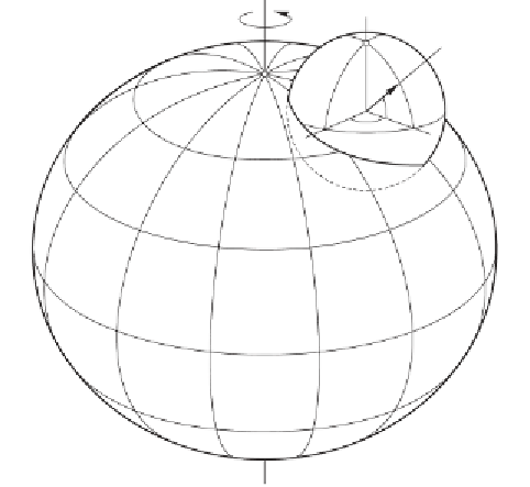
The direction of the earth's axis of rotation and the position of the equa-
torial plane (normal to the axis) are well defined astronomically. The
astro-
nomical latitude
Φofapoint
P
is the angle between the vertical (direction
of the plumb line) at
P
and the equatorial plane, see Fig. 2.7. From this
figure, we also see that line
PN
is parallel to the rotation axis, plane
GP F
normal to it, that is, parallel to the equatorial plane;
n
is the unit vector
along the plumb line; plane
NPF
is the meridian plane of
P
, and plane
NPG
is parallel to the meridian plane of Greenwich.
Consider now a straight line through
P
parallel to the earth's axis of
rotation. This parallel and the vertical at
P
together define the meridian
plane of
P
. The angle between this meridian plane and the meridian plane
of Greenwich (or some other fixed plane) is the
astronomical longitude
Λof
P
. (Exercise: define Φ and Λ without using the unit sphere. The solution
may be found in Sect. 5.9).
unit sphere
N
vertical
n
P
G
F
uato
r
earth
Fig. 2.7. Definition of the astronomical coordinates Φ and Λ of
P
by
means of a unit sphere with center at
P