Geoscience Reference
In-Depth Information
5.4.1
Point positioning with code pseudoranges
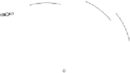
The situation is shown in Fig. 5.2. The coordinates of
A
aretobedetermined
by using GPS. As we know from Sect. 5.3.4, four pseudoranges to different
satellites are necessary to determine the three coordinate components of
A
and the receiver clock error. Generalizing (5-3), we obtain
R
j
A
(
t
)=
j
A
(
t
)+
cδ
A
(
t
)
.
(5-6)
Thisisthecodepseudorangeatanepoch
t
,where
R
j
A
(
t
) is the measured
code pseudorange between the observing site
A
(as indicated in Fig. 5.2) and
the satellite
j
,and
j
A
(
t
) is the geometric distance between the satellite and
the observing point, and
c
is the speed of light. The last item is the receiver
clock error
δ
A
(
t
). Note that we assume the simplest possible model, thus,
we do not consider ionospheric and tropospheric influences, other biases and
errors.
Examining Eq. (5-6), the desired point coordinates to be determined are
implicitly comprised in the distance
j
A
(
t
)
,
which can explicitly be written
as
j
A
(
t
)=
(
X
j
(
t
)
X
A
)
2
+(
Y
j
(
t
)
Y
A
)
2
+(
Z
j
(
t
)
Z
A
)
2
,
−
−
−
(5-7)
where the WGS 84 (World Geodetic System 1984, see Sect. 2.11) coordinates
X
j
(
t
)
,Y
j
(
t
)
,Z
j
(
t
) are the components of the geocentric position vector of
the satellite at epoch
t
,and
X
A
,Y
A
,Z
A
are the three unknown WGS 84 co-
ordinates of the observing site, which might be denoted (
X
A
,Y
A
,Z
A
)
WGS 84
or, which means the same, (
X
A
,Y
A
,Z
A
)
GPS
.
How many unknowns are involved? Note that the satellite coordinates
X
j
(
t
)
,Y
j
(
t
)
,Z
j
(
t
) may always be assumed known (more precisely, are cal-
k
l
j
k
%
A
(t
m
Z
WGS-84
l
%
A
(t
m
j
%
A
(t
%
A
(t
A(
A
,
Y
AA
, )
Y
WGS-84
Z
A
X
A
X
WGS-84
Y
A
Fig. 5.2. Point positioning