Travel Reference
In-Depth Information
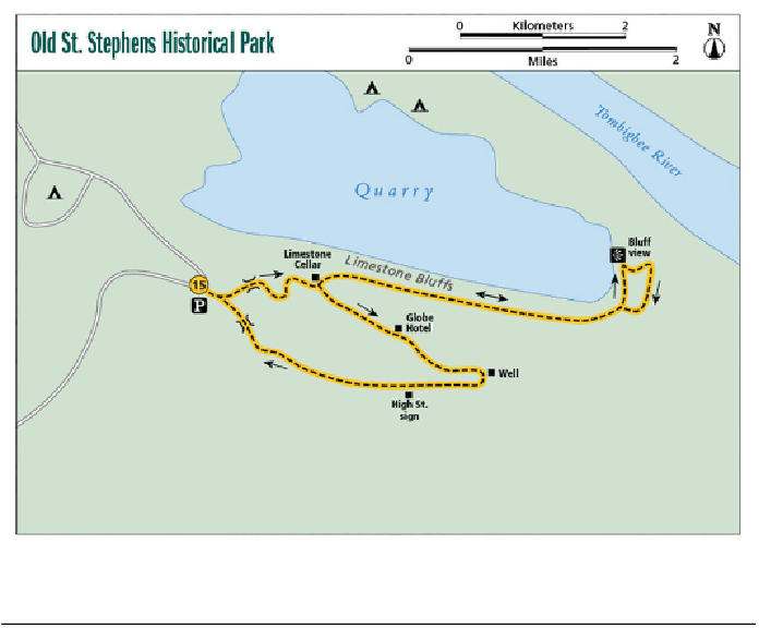
Miles and Directions
Start at the trailhead a few yards to the southeast of the parking
lot. A small building housing informative panels describing the
town's history and the site's archaeology is there. The trail be-
gins to the right of the building. In a few short yards, come to a
Y. The right fork is the return route; take the left fork (east) and
a few yards later cross a short bridge over a creek. Another
short walk takes you to a sign that reads “You are now crossing
Chambers Street” and describes where you are, but the rest of
the sign is hard to read. Follow the path up the hill to a dirt road
and turn to the right (east) onto the road. To the left you will see
the archeological building.
0.0
Pass the remnants of a limestone cellar labeled 142 H
IGH
S
TREET
and a marble marker. Just past this the trail comes to a
Y (a sign reading “High Street” is in the center of the Y). Take
0.2
Search WWH ::

Custom Search