Travel Reference
In-Depth Information
5
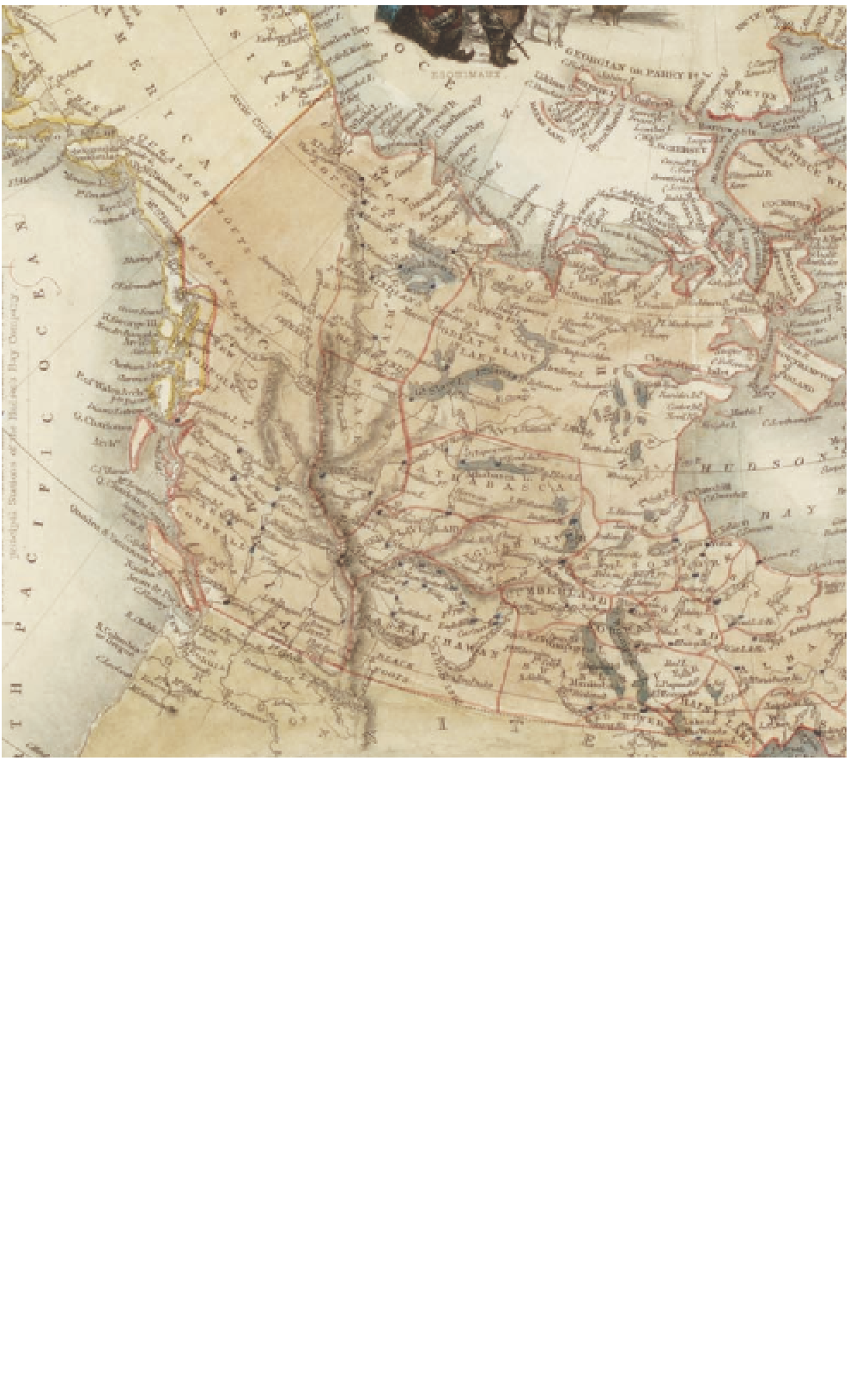
The Canadian West during the British colonial period.
© Archives Canada, NMC-141864
but rather lies across the Strait of Juan
de Fuca, on the mainland. The Queen
Charlotte Islands or Haida Gwaii lie to
the north. The maritime nature of the
province is foremost in many minds,
but in actuality three quarters of the
province lies an average of more than
930m above sea level, and a 3,000m-
high barrier of mountains is visible
from the coast. From west to east, a
succession of mountain ranges stretch-
es all the way to the famous Rocky
Mountains, whose summits reach up to
4,000m. This chain was named for its
bare, rocky eastern slopes.
During the Precambrian era, the
Pacifi c Ocean covered most of Western
Canada. Over a period of about 500
million years, the ocean advanced
and receded, depositing sediment on
the Precambrian rock of the Canadian
Shield, one of the oldest rock forma-
tions on earth. Microscopic organisms
in the sea died, creating enormous
amounts of decaying organic matter,
at the source of Alberta's huge oil de-
posits. By the Cretaceous period, some
75 million years ago, the Arctic Ocean
had fl ooded most of Alberta, creating a
vast inland sea known as the Bearpaw.
Search WWH ::

Custom Search