Travel Reference
In-Depth Information
THE STEWART-CASSIAR
HIGHWAY
Completed in 1972, the Stewart-Cassiar
Highway (Highway 37) is the trucking
route used to bring supplies to com-
munities in the northern part of the
province and beyond. While the trip is
a bit shorter than the Alaska Highway,
the scenery is equally magnifi cent.
The Road to Stewart
Heading out from Meziadin Junction
along the Stewart-Cassiar Highway, trav-
ellers can reach Alaska (U.S.A.) by fol-
lowing Highway 37A, aptly nicknamed
the Glacier Highway. You will notice a
major change in the scenery along the
way. The mountains, with their snow-
and glacier-capped peaks, look more
and more imposing the closer you get.
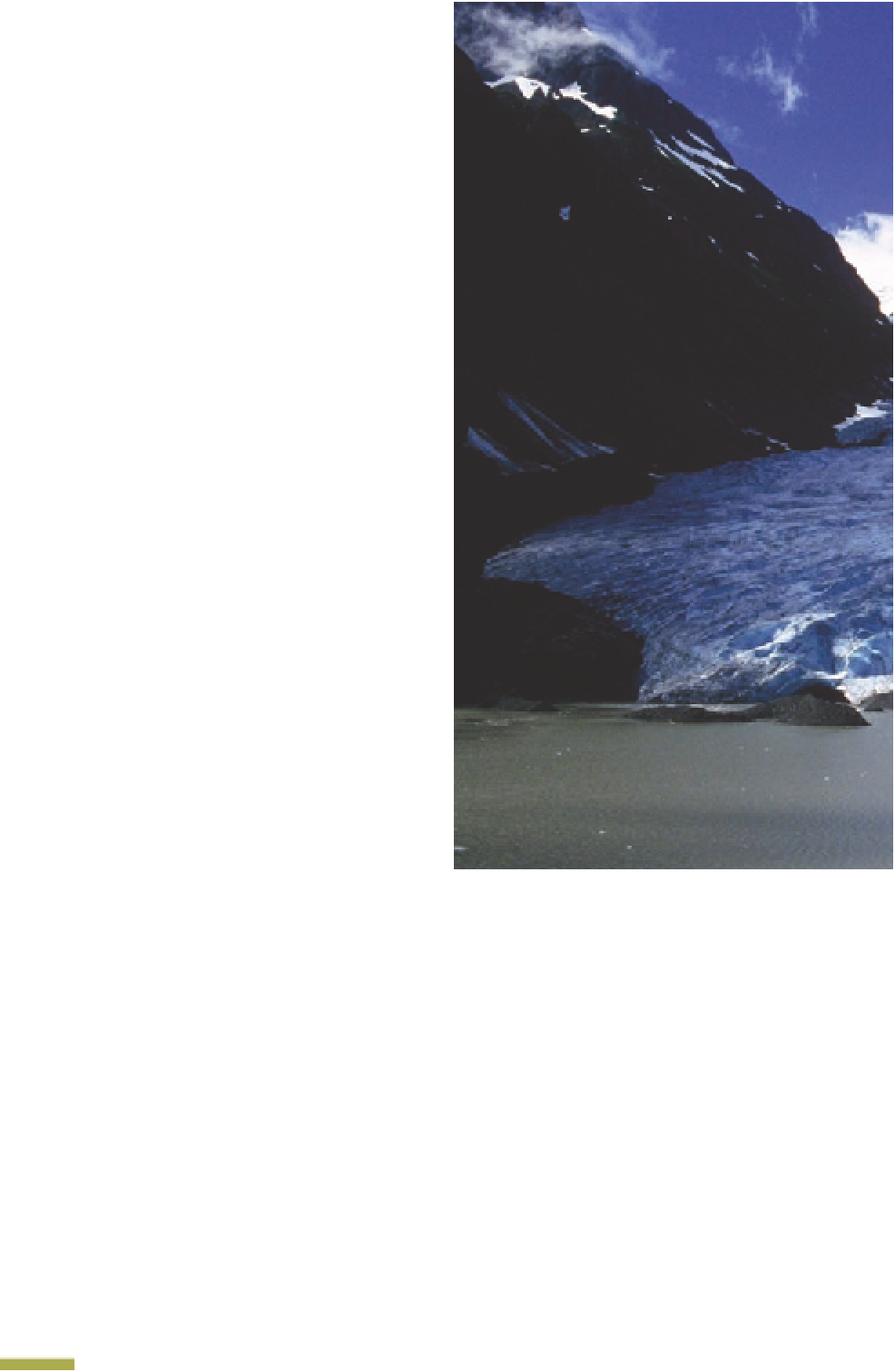
Exactly 23km from Meziadin Junction,
around a bend in the road, you will
be greeted by the spectacular sight of
Bear Glacier
, which rises in all
its azure-coloured splendour out of the
milky waters of Strohn Lake at the same
level as the road!
5
Bear Glacier ensconced amid the rocks.
© Pierre Longnus
Nineteen kilometres further lies
Stewart
, a frontier town lo-
cated just 2km from the little village of
Hyder, Alaska. Both communities lie at
the end of the 145km-long Portland
Canal, the fourth deepest fjord in the
world. In addition to forming a natural
border between Canada and the United
States, this narrow stretch of water gives
Stewart direct access to the sea, making
this little town, surrounded on all sides
by towering, glacier-studded moun-
tains, the most northerly ice-free port
in Canada. In summer, the mild tem-
perature is governed by the occasion-
4
Peaks covered with perpetual snow tower
over the Portland Canal.
© Pierre Longnus
ally damp Pacifi c climate, while heavy
snowfall is common in the winter (over
20m total).
Mount Edziza Provincial
Park
Heading back north from Meziadin
Junction along the Stewart-Cassiar
Highway, travellers will cross Mount
Edziza Provincial Park. Covering
260,000ha in the northwest part of the
province, west of the Iskut River and


Search WWH ::

Custom Search