Geography Reference
In-Depth Information
Lake Pontchartrain
Kenner
Kenner
Metairie
Metairie
New Orleans
New Orleans
Jefferson
Jefferson
River Ridge
Harahan
River Ridge
Harahan
Arabi
Arabi
Elmwood
Elmwood
Chalmette
Chalmette
Waggaman
Waggaman
Bridge City
Bridge City
Meraux
Meraux
Gretna
Gretna
Avondale
Avondale
Terrytown
Terrytown
Violet
Violet
Westwego
Westwego
Harvey
Harvey
Marrero
Marrero
Timberlane
Timberlane
Poydras
Poydras
Woodmere
Woodmere
Estelle
Estelle
Belle Chasse
Belle Chasse
0
5
10 km
Elevation
Absolute Population Change
1970 - 2000
Incorporated area
8,500
4,250
850
-850
-4,250
-8,500
Katrina Flood
Sept. 02, 2005
2 m
1 m
0 m
Source: US Census bureau
Designed and made by JM Zaninetti, University of Orleans, CEDETE Institute
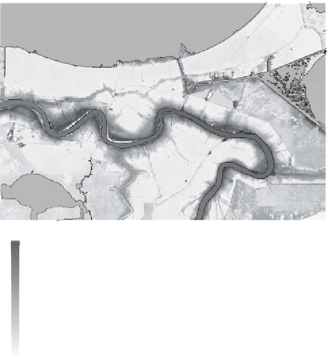
Figure 9.5.
New Orleans urban sprawl, 1970-2000
Urban sprawl was limited to areas covered under the HPS. Limited urban
development occurred following the partial enclosure of the East Bank of St Charles
Parish, but it is on the north shore of Lake Pontchartrain that urban sprawl was most
evident. Urban sprawl in St Tammany Parish is the result of the opening in 1956 of
the Lake Pontchartrain Causeway, a 35-km causeway linking Metairie on the south
shore of Lake Pontchartrain and Mandeville to the North, and the opening, two years
later, of the Pontchartrain Expressway. While the populations of Jefferson and St
Bernard parishes stabilized by 1980, the St Tammany Parish population doubled
between 1980 and 2005, from 110,000 to 220,000. The depopulation of the city of
New Orleans since 1960 is the main consequence of urban sprawl. It is estimated