Geography Reference
In-Depth Information
LAKE PONTCHARTRAIN
MR-GO
LAKE
BORGNE
Jefferson
Mississippi
Orleans
St. Bernard
Plaquemines
0
5
10 km
LAKE SALVADOR
Flood depth
Land below sea level
protected by the levees
2 m
Damages caused by Katrina
HPS Levees
Breaches
Foundation's defect
1 m
0.3 m
Sources: USGS (elevation), FEMA (Storm Surge),
Army Corps of Engineers (Levees height)
0 m
Designed and made by JM Zaninetti, University of Orleans, CEDETE Institute
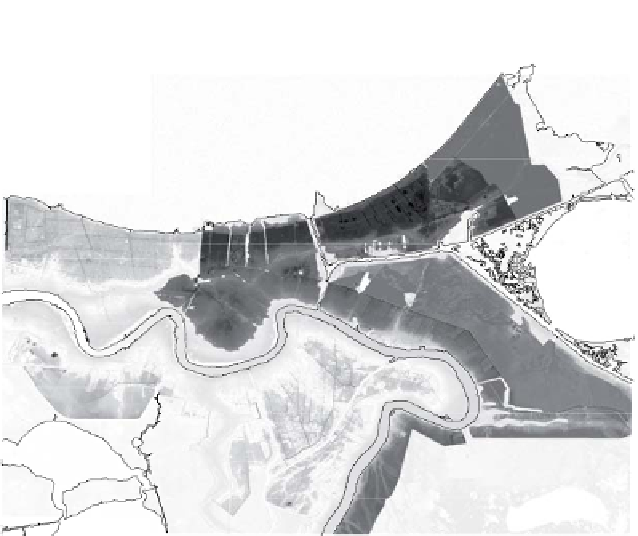
Figure 9.2.
New Orleans, Katrina flooding as of September 2, 2005
New Orleans was flooded because protective floodwalls collapsed under
pressure of the tidal surge (see Figure 9.2). This said, the location of these failures
was not purely accidental.