Geography Reference
In-Depth Information
inequality in America finally entered the public consciousness. In retrospect, it
became evident that racial segregation and poverty had made New Orleans even
more vulnerable to the natural hazard whose inevitable occurrence was simply a
matter of when.
Lake Pontchartrain
10
0
5
10 km
Elevation
Actual levee's height
meters
less than 3
3 to 4.5
4.5 to 6
6 to 7.5
2
1
0
0.3
meters
Sources: USGS, Army Corps of Engineers
Designed and made by JM Zaninetti, University of Orleans, CEDETE Institute
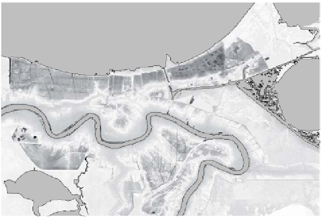
Figure 9.1.
New Orleans physical relief
and hurricane flood protection system, 2005
Most of the Mississippi delta is less than 1 m above sea level, a fact which, when
combined with surrounding wetlands and larger bodies of water (Lakes Borgne,
Pontchartrain and Maurepas to the north, and Lakes Salvador and des Allemands to
the south), long restricted the expansion of New Orleans. The course of the
Mississippi River therefore represents the high point of the region, which, with the